Synopsis:
The low that gave parts of the region a deluge last night will move off the coast early this morning. The sun will return and readings for a change will be above average. The average high is 59º.
Scattered showers are in the forecast tonight as the next weaker system moves our way.
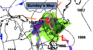
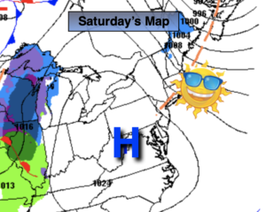
An upper level low will move over the Northeast this weekend. This will result in cool readings and scattered showers on Saturday. There will be dry times. Sunday will be the better half of the weekend under a mix of sun and clouds. An isolated shower can’t be ruled out later in the day. It’ll still be cool.
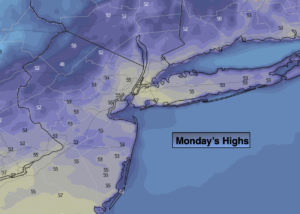
On Monday high pressure will replace low pressure. This will result in plenty of sunshine and pleasant readings.
Tuesday will be mild as a Southwest flow develops around high pressure moving off the Southeast coast.
Stay tuned.
Keep it here for a no hype, no nonsense forecast.
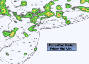
Friday:
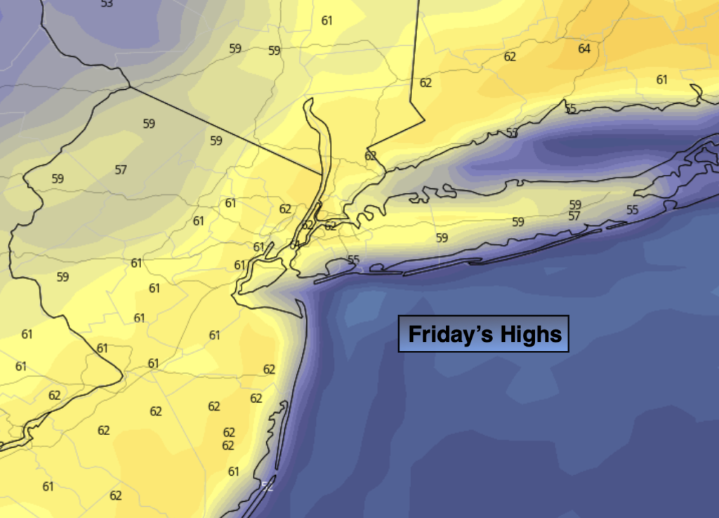
Sun and clouds. Milder than recent days. Highs in the lower 60s. West to Southwest winds at 8-12mph.
Tonight:
Mostly cloudy with scattered showers. Lows in the 40s throughout. Southwest to Southeast winds at 5-10mph.
Saturday:
Mostly cloudy with scattered showers. Breezy. Highs in the mid to upper 50s.
Sunday:
Sun and clouds. Cool. An isolated late day shower. Highs in the lower to mid 50s.
Monday:
Mostly sunny. Highs around 60º.
Tuesday:
Partly sunny. Milder. Highs in the mid to upper 60s.
Catch me on the Fox Weather Stream from 10am-1pm on Friday. Find us on Tubi, Roku TV and YouTube TV and as always the Fox Weather App.