Synopsis:
Our warm readings of the last several days will give way to dramatically colder conditions. Dry Easter bonnets are expected today as high pressure moves in. A chilly breeze will be with us with readings at least ten degrees below average high of 62º. It will be a shock heading outdoors.
Tonight will be clear and cold. Lows inland will dip below freezing.
Sun will give way to clouds on Monday as a low pressure begins to move in from the South. Rain is likely by evening Monday. Rain could be heavy for a while Monday night.
The storm will move into Eastern New England on Tuesday. Morning clouds will give way to sunny skies. Highs will be several degrees below average.
Wednesday will be bright and pleasant readings as high pressure builds overhead. Pleasant conditions will continue into Thursday.
Stay tuned.
Keep it here for a no hype, no nonsense forecast.
Happy Easter!
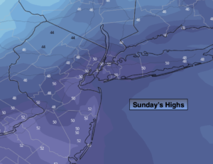
Easter Sunday:
Party sunny, breezy and cooler. Highs only in the 40s to around 50º. Northwest winds at 15-25mph with higher gusts.
Tonight:
Clear. Much colder. Lows in the upper 30s in the City, the 20s inland. Northwest winds at 8-15mph and diminishing.
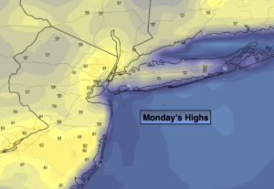
Monday:
Sun to clouds. Rain developing by evening. Highs in the mid 50s.
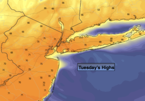
Tuesday:
Early morning clouds to sun. Highs in the mid 50s.
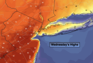
Wednesday:
Sunny. Highs around 60º.
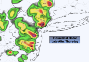
Thursday:
Partly sunny. Milder. Highs in the mid 60s.
Catch me on the Fox Business Network this weekend from 6am-9am and on the Fox Weather Stream until Noon. Find us on the stream on Tubi, Roku TV and YouTube TV and as always the Fox Weather App. It’s Free!