Synopsis:
Rain will end this morning as low pressure moves offshore. It looks like the clouds will dominate much of the day form the City and to the North and East. For this reason temperatures will remain below the average high of 72º. Farther inland, some sun may shine resulting in warmer temperatures.
A warm front will move into the region on Friday. It should come through precipitation free. The latest computer guidance suggests the front may get hung up just to the South of the City. The potential for clouds dominating the day with a Southeast flow off the cooler Atlantic has increased. Due to these factors, readings will most likely be cooler than previously thought. Highs now look to be more seasonal, with warmer temperatures more like over Southern and Western regions.
By Saturday, a deep Southerly flow will develop around a Bermuda high. Readings will skyrocket to Summer-like readings under plenty of sunshine. Many areas just away from the coast will crack 90º.This pattern will continue for Sunday. Sunday may very well be the hotter of the two days for the City.
A cool front will move through the region Sunday night with scattered showers and maybe a rumble of thunder. Relief will arrive Monday behind the front under a mix of sun and clouds.
Stay tuned.
Keep it here for a no hype, no nonsense forecast.
Thursday:
Rain ending this morning. Remaining mostly cloudy. Highs in the 60s in the City and to the North and East. Warmer inland. East to West winds at 5-10mph.
Tonight:
Partly cloudy. Lows in the 50s throughout. Light and variable winds.
Friday:
Clouds, some sun. Highs around 70º in the city. Cooler at the coast, much warmer inland.
Saturday:
Mostly sunny. Hot and humid. Highs in the upper 80s to lower 90s, cooler at the coast.
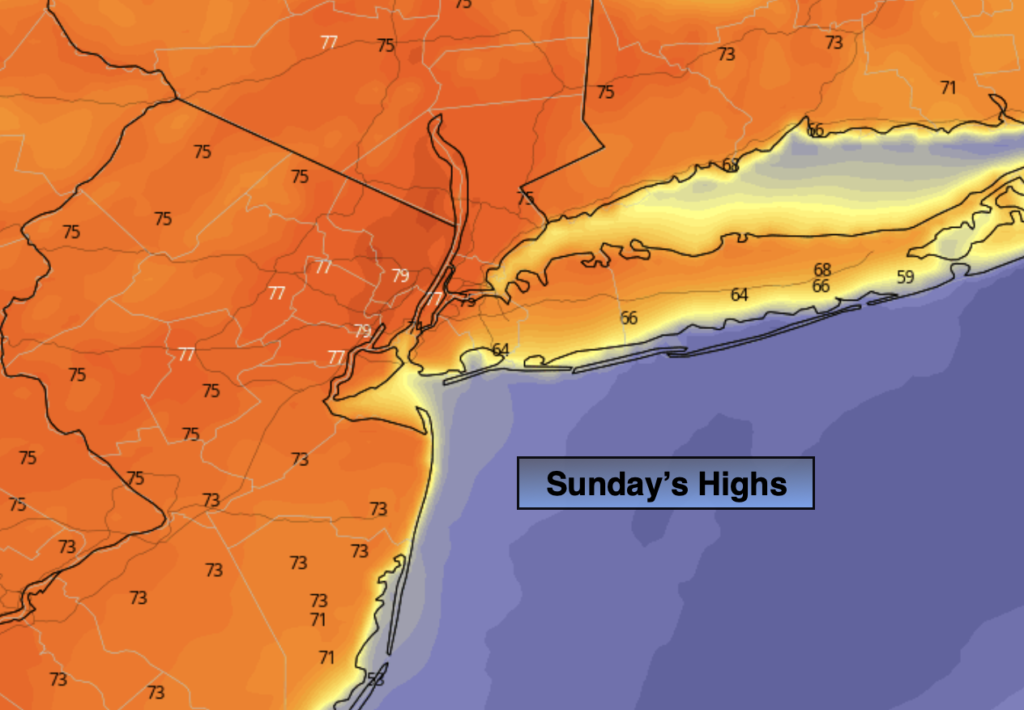
Sunday:
Hazy, hot and humid. Highs in the upper 80s to lower 90s. Cooler at the coast.
Monday:
Partly sunny. Much more comfortable. Highs in the mid 70s.
Catch me on the Fox Weather Stream from 10am-1pm Thursday. Find us on Tubi, Roku TV and YouTube TV and as always the Fox Weather App. It’s Free!