Synopsis:
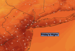
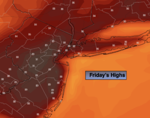
Friday will be quite warm to hot as high pressure builds over the region. Humidity levels will be tolerable by August standards under a mostly sunny sky
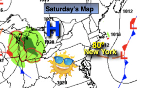
The weekend will feature higher humidity levels, under a mix of sun and clouds as high pressure slips offshore.
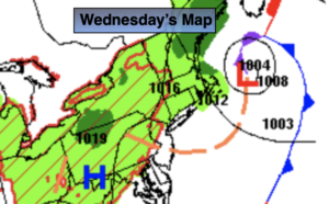
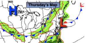
On Monday weak low pressure over the Ohio Valley should draw moisture up from the South. Showers are in the forecast. Lets keep our fingers crossed as many areas desperately need the rain.
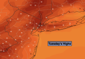
By Tuesday this system should pull to the North. Any early morning showers and clouds should give way to a brighter afternoon.
Keep it here for a no hype, no nonsense forecast.
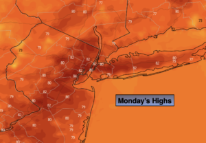
Friday:
Mostly sunny. Warmer. Highs in the upper 80s to around 90º. Cooler at the coast. Northwest to South winds at 5-10mph.
Tonight:
Clear. Lows in the lower 70s in urban areas, the 60s North and West. Southwest winds at 5mph.
Saturday:
Partly sunny. More Humid. Highs in the mid 80s.
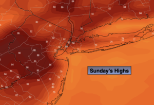
Sunday:
Partly sunny. Humid. Highs in the mid 80s.
Monday:
Mostly cloudy with scattered showers. Humid. Highs in the lower 80s.
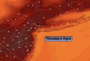
Tuesday:
Early morning showers possible, otherwise clouds giving way to brighter skies. Highs in the mid 80s.
Catch me on the Fox Weather Stream from 10am-1pm Friday. Find us on Tubi, Roku TV and YouTube TV and as always the Fox Weather App. It’s Free!