Synopsis:
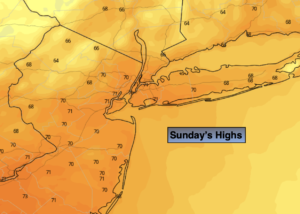
Father’s Day will continue with a Fall feel as chilly high pressure dominates from Canada. Mainly sunny skies are expected, there will be a breeze. Readings will be ten below the average high of 81º. Not bad in my book (ok, I would prefer it a bit warmer).
Another chilly night is on the way with readings inland once again dipping into the 40s.
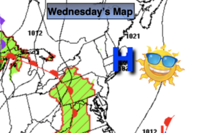
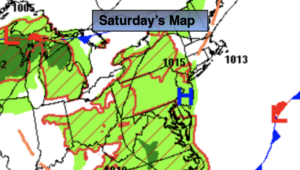
The beginning of the week will be bright as high pressure moves overhead.
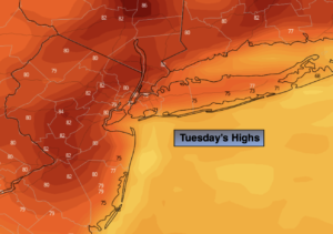
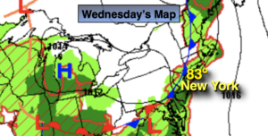
More clouds are expected Tuesday (the first day of Summer) as a warm front approaches. A few showers are possible later in the day.
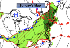
The warm front looks to get hung up over the region Wednesday. It now looks as thought the heat and humidity will stay just to our West. Scattered showers are possible just about anytime. It doesn’t look like a washout.
Thursday will feature abundant sunshine and seasonable readings as high pressure builds over the region.
Stay tuned.
Keep it here for a no hype, no nonsense forecast.
Father’s Day:
Mostly sunny. Breezy. Highs in the 66º-73º. Northwest winds at 10-20mph with gusts to 25mph.
Tonight:
Clear and chilly. Lows in the upper 50s in the City, the 40s & 50s inland. Northwest winds diminishing to 5-10mph.
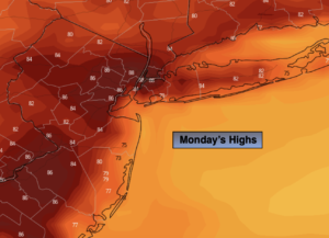
Monday:
Sunny. Highs in the upper 70s.
Tuesday:
Mostly cloudy with spotty showers possible. Highs in the mid 70s.
Wednesday:
Clouds and sun. Scattered showers. Highs in the upper 70s.
Thursday:
Partly sunny. Highs in the lower 80s.
Catch me on the Fox Business Network from 6am- 9am this weekend and on Weather Stream until 10am. Find us on Tubi, Roku TV and YouTube TV and as always the Fox Weather App. It’s Free!