Synopsis:
High pressure will build along the Northeast coast through today. Bright, comfortable conditions will continue. Readings will be near the average high of 79º.
A few showers or isolated storms are possible Thursday as a warm front moves into the region.
By Friday, the winds will turn to the West ahead of a cool front. This will result in a spike in temperatures. In fact, some areas may reach into the lower 90s. An isolated storm can’t be ruled out with the passage of the cool front later in the day. Most areas will be storm-free.
Father’s Day Weekend at this time looks sunny with comfortable readings as a North wind dominates around high pressure to the West.
Stay tuned.
Keep it here for a no hype, no nonsense forecast.
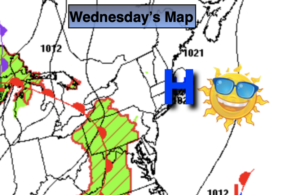
Wednesday:
Sunny. Highs around 80º. Northeast to Southeast winds at 5-10mph.
Tonight:
Becoming mostly cloudy late. Scattered showers possible toward daybreak. Lows in the mid 60s in the City, the lower 60s inland. Southeast winds at 5mph.
Thursday:
More clouds than sun. Spotty showers and possibly an isolated storm. Highs in the upper 70s.
Friday:
Partly sunny. Hot. An isolated afternoon storm is possible. Highs in the upper 80s to lower 90s.
Saturday:
Mostly sunny. Seasonable. Highs in the upper 70s.
Father’s Day:
Mostly sunny. Highs in the upper 70s.
Catch me on the Fox Weather Stream from 4pm-7pm Wednesday. Find us on Tubi, Roku TV and YouTube TV and as always the Fox Weather App. It’s Free!