Synopsis:
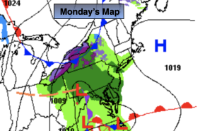
Monday will start off with sun, but clouds will increase during the day with showers likely by mid to late afternoon as weak low pressure slides to our South. A few hours of steady rain is expected for the evening commute.
Showers will end by late evening with skies remaining mostly cloudy. All area temperatures will remain above freezing.
Bright, seasonable conditions are expected Tuesday through Thursday as high pressure gains dominance over the Eastern Seaboard.
The next chance of showers will arrive on Friday as a front moves in from the West.
Stay tuned.
Keep it here for a no nonsense, no hype forecast.
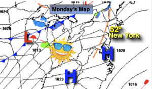
Monday:
Sun early, otherwise thickening clouds with showers likely by mid to late afternoon from West to East. A few hours of steady rain by the evening commute. Highs in the lower to mid 50s. East winds at 5-10mph.
Tonight:
Showers early, otherwise remaining mostly cloudy. Lows in the 30s throughout. Northeast to North winds at 8-12mph.
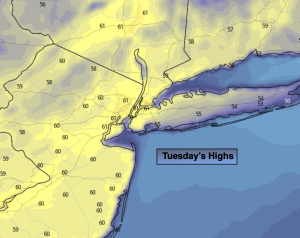
Tuesday:
Partly sunny. Highs in the lower 50s.
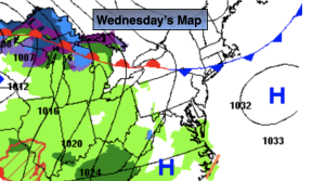
Wednesday:
Sunny. Highs in the lower 50s.
Thursday:
Sunny. Highs in the lower 50s.
Friday:
Mostly cloudy with a chance of showers. Highs in the mid 50s.