Synopsis:
The beginning and mid portion of the upcoming week will make most smile. Near seasonable readings are anticipated for today as high pressure begins to modify. Today is the beginning of Spring! The Vernal Equinox occurs at 5:24pm EDT. This is the exact moment when the sun’s direct rays are over the equator on it’s way Northbound.
The rest of the week will feature readings well above the average high of around 50º. Strong March sun and lack of cold air in the East will attribute to our nice Spring start. A weakening front will approach from the West on Thursday with more clouds and just the chance of a few showers. The threat of showers will continue Friday as the front get hung up. Friday’s forecast could turn out for the better.
Stay tuned.
Keep it here for a no nonsense, no hype forecast.
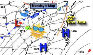
Monday:
Sunny. Highs around 50º. West to Southwest winds at 8-12mph.
Tonight:
Clear. Lows around 40º along the urban corridor, the 20s and 30s inland. Southwest to West winds at 5mph.
Tuesday:
Sunny. Milder. Highs upper 50s to around 60º.
Wednesday:
Sun to late clouds. Mild. Highs in the upper 50s.
Thursday:
Sun and clouds. Warm. Spotty showers possible. Highs in the mid 60s.
Friday:
Clouds and sun Warm. Spotty showers possible. Highs in the lower 60s.