Synopsis:
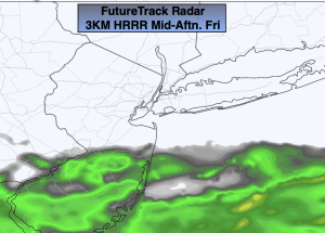
A cool front will move into the region this morning and weaken considerably. Clouds and some sun is expected for Friday. Scattered showers are possible for parts of Central and Southern NJ. Highs of a couple degrees above the average high of 52º are expected.
Tonight will be partly cloudy. Lows will remain above freezing in all areas.
On Saturday, low pressure will develop over the Ohio Valley and move into the Great Lakes. On and off showers with areas of drizzle are likely with readings below average.
Sunday will be the brighter and milder half of the weekend as high pressure dries the Northeast out.
It’ll be a tranquil start to the week as high pressure moves in with near seasonable averages.
Stay tuned.
Keep it here for a no nonsense, no hype forecast.
Friday:
Clouds, some sun. Scattered showers possible over Southern Areas. Highs in the mid 50s. Northwest winds at 5-10mph.
Tonight:
Partly cloudy. Lows in the 30s to around 40º. Northeast winds at 5mph.
Saturday:
Cloudy with scattered showers and areas of drizzle. Cooler. Highs in the upper 40s.
Sunday:
Sunny. Mild. Highs around 60º.
Monday:
Mostly sunny. Highs in the mid to upper 50s.
Tuesday:
Partly sunny. Highs in the lower 50s.