Synopsis:
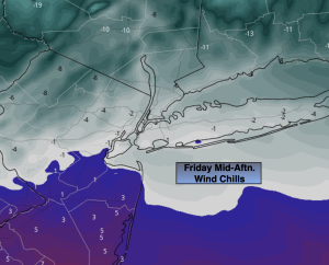
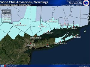
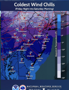
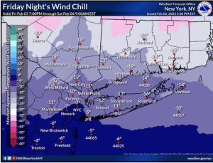
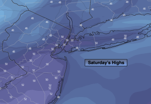
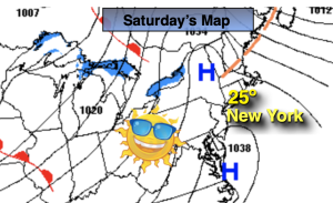
It was the coldest morning of the season for many areas. Frigid sunshine will greet us for the first Saturday of February. A strong Arctic high will settle over the region. Early morning wind chills will be near or below zero, but the good news (if any) is the the winds will diminish during the morning hours. Temperatures will remain at least ten to fifteen degrees below average for afternoon highs.
Temperatures tonight in urban areas will remain steady from Saturday’s highs as the core of the frigid air moves far out into the Atlantic. Inland readings will drop some.
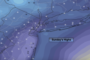
Readings will soar on Sunday as the Arctic high rapidly moves offshore and a return Southwest flow develops. temperatures will be at around twenty degrees higher than Saturday. The latter half of the weekend will definitely be the better half. It will feel like Spring by later afternoon! The tale of two seasons in one weekend.
Monday through Wednesday will feature a mix of clouds and sun as another high moves in from the West. Readings will be above average. Not feeling like February whatsoever.
Stay tuned.
Keep it here for a no hype, no nonsense forecast.
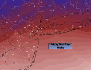
Saturday:
Frigid sunshine. Highs 20º-26º. Northwest to Southwest winds diminishing to 5-10mph.
Tonight:
Partly cloudy. Temperatures remaining steady along the urban corridor . Dropping into the teens to around 10º inland. Southwest winds at 5-10mph.
Sunday:
Partly sunny. Much milder. Highs in the lower to mid 40s.
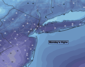
Monday:
Partly sunny. Mild. Highs in the upper 40s to around 50º.
Tuesday:
Partly sunny. Highs in the upper 40s to around 50º.
Wednesday:
Mostly sunny. Highs in the lower 50s.