Synopsis:
The next five days will not be a washout.
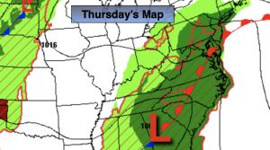
A weak low over the Mid-Atlantic will move North the next 24 hours. On and off showers and storms are expected today. There will be dry times. Readings will be just below the average high of the lower 80s.
Scattered showers and storms will continue tonight.
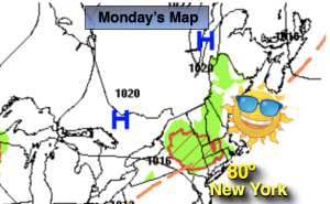
High pressure will shift off the coast on the weekend. This will result in a Southerly flow of humid air. A mix of sun and clouds is expected with a chance of a few showers or storms into Monday. It will not be a washout. It’ll be warm and humid.
The threat of showers will continue into Tuesday as a front stall over the region.
Stay tuned.
Keep it here for a no nonsense, no hype forecast.
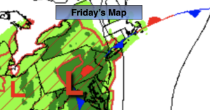
Friday:
Mostly cloudy. Scattered showers and isolated storms. Highs in the upper 70s. Southeast winds 8-12mph.
Tonight:
Scattered showers and storms. Muggy. Lows in the upper 60s in the City, the mid 60s inland. Southeast winds less than 5mph.
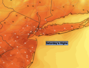
Saturday:
Sun and clouds. Humid. Spotty PM showers and storms. Highs in the lower 80s.
Sunday:
Sun and clouds. Humid. Spotty PM showers and storms. Highs in the mid 80s.
Monday:
Sun and clouds. Humid. Spotty PM showers and storms. Highs in the mid 80s.
Tuesday:
Chance of showers. Highs around 80º.