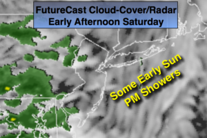
Synopsis:
High pressure will slip offshore today. The return flow will pump up mild air from the South. A cold front will approach during the afternoon with any sun giving way to scattered showers by afternoon. It will not be a washout. In fact, much of the day should be dry. Ahead of the front tonight a warm push of air will move into the area. Temperatures will actually rise into and through the 50s! The showers will continue tonight and into Sunday Morning. The sun should return Sunday afternoon. It’ll be windy on Sunday with a mild start but colder air will spill into the region by afternoon as temperatures begin to fall.
Looking down the pike into Thanksgiving week it looks tranquil through Thanksgiving with the rollercoaster ride in temperatures continuing.
Stay tuned.
Today:
Some morning sun otherwise clouds will thicken. Scattered showers are possible anytime from mid-day on. It will not be a washout. Mild. Highs will occur during the evening. Readings will rise through the 40s and into the 50s in most regions. Southwest winds at 10-15mph.
Tonight:
Scattered showers. Balmy. Temperatures through 50s and to near 60º over Eastern areas. Southwest winds increasing to 15-25mph with gusts to 35mph late.
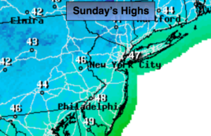
Sunday:
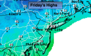
Morning showers will give way to afternoon sun. Windy. Highs in the 50s during the morning. Temperatures will fall into the 40s by sunset.
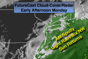
Monday:
Partly sunny, cooler. Highs in the lower to mid 40s.
Tuesday:
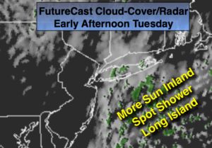
Mostly sunny, milder. Highs in the lower 50s.
Wednesday:
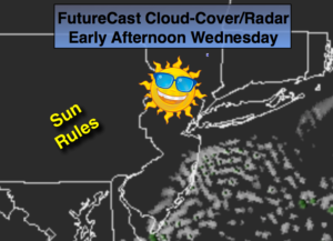
Partly sunny. Highs around 50º.
Keep it here for a no nonsense, no hype forecast.