Synopsis:
A weak area of low pressure will move into the region tonight and Monday morning. Spotty light rain is possible late tonight through mid-day Monday. It may be just cold enough well inland for a bit of sleet or wet snow to mix in. This will not be a big deal for travel. The sun should return during the afternoon from West to East as the system moves offshore.
Tranquil conditions are expected for the week as high pressure systems dominate. Readings will be just below or near average. The average high is in the mid 50s. Another weak area of low pressure will move through Thursday. The system have limited moisture so the chance of any precipitation is very low.
Looking down the pike, another cold blast will affect the region by Sunday.
Stay tuned.
Tonight:
Partly cloudy. Thickening clouds late. A bit of light rain is possible late. Light wet snow, sleet or freezing rain is possible well inland. It shouldn’t be a big issue. Lows in the upper 30s in the City the 20’s inland. Northeast winds will be nearly calm.
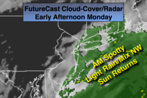
Monday:
Morning spotty light rain or a light mix well inland, otherwise, becoming partly sunny during the afternoon. Highs in the upper 40s. Northeast to North wind at 5-10mph.
Tuesday:
Mostly sunny. Highs in the upper 40s.
Wednesday:
Mostly sunny. Highs in the lower 50s.
Thursday:
Partly sunny. Highs in the mid 50s.
Friday:
Mostly sunny. Highs in the upper 40s.
Keep it here for a no nonsense, no hype forecast.