Synopsis:
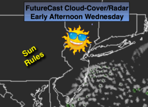
High pressure will dominate the East Coast resulting in partly to mostly sunny skies today.
A front moving in from the West will bring showers late tonight into Thursday morning. Readings will finally be near seasonal levels on Thursday. The average high is 54º.
Another high will move for Friday bringing with it cooler and sunny conditions.
High pressure will slip offshore Saturday. The return flow will pump up mild air from the South. A cold front will approach during the afternoon with any sun giving way to showers by afternoon. The showers will continue Saturday night and into Sunday Morning. The sun should return Sunday afternoon and it will turn colder.
Looking down the pike into Thanksgiving week it looks tranquil through Thanksgiving.
Stay tuned.
Today:
Mostly sunny inland. Partly sunny coastal areas. Highs in the upper 40s. Northeast to Southeast Winds at 5-10mph.
Tonight:
Thickening clouds. Showers late. Milder than recent nights. Lows in the mid 40s in the City the upper 30s inland. Southeast winds at at 5-10mph.
Thursday:
Morning showers, otherwise, becoming partly sunny. Highs in the mid 50s.
Friday:
Mostly sunny. Highs in the upper 40s.
Saturday:
Morning sun will give way to afternoon showers. Highs in the mid to upper 50s.
Sunday:
Morning showers will give way to afternoon sun. Highs in the upper 40s.
Keep it here for a no nonsense, no hype forecast.