Synopsis:
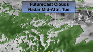
Another Spring-like Day is will be with us today. Skies will be mostly cloudy. Showers will arrive this afternoon as a cool front moves toward the region.
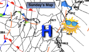
Wednesday and Thursday will feature plenty of sun and mild readings as high pressure works in from the North and West with a lack of cold air.
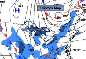
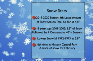
On Friday there will be a developing storm off the coast and a clipper moving in from the North and West. At this time it looks as though the ocean storm will not connect with the clipper until its well to the East of the City. This scenario would result in rain showers possibly going over to snow showers by evening and at night. The snow drought continues.
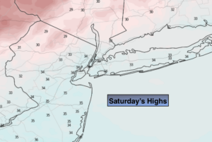
Saturday will be windy and colder under a mix of sun and clouds.
Stay Tuned.
Keep it here for a no nonsense, no hype forecast.
Today:
Mostly cloudy with afternoon showers. Balmy. Highs in the upper 50s. South to Southeast winds at 5-10mph.
Tonight:
Scattered showers. Mild. Lows will be in the lower to mid 40s throughout (this is nearly the average high for the day)! Southwest winds becoming Northwest and increasing to 10-20mph late.
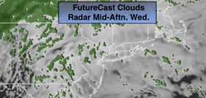
Wednesday:
Mostly sunny. Breezy. Highs in the lower to mid 50s.
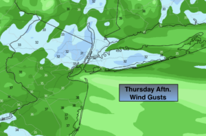
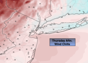
Thursday:
Mostly sunny. Highs around 50º.
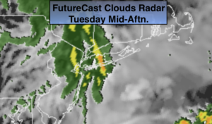
Friday:
Mostly cloudy with showers possible by midday and afternoon. Snow showers may mix in late day and continue at night. Highs in the mid 40s.
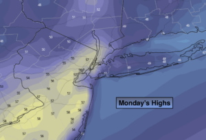
Saturday:
Partly sunny, windy and cold. Highs around 40º.