Synopsis:
High pressure over the Northeast will slip off the coast today. Clouds will give way to some sun. Temperatures will be slightly above average.
A weak system will move in from the West tonight and Monday. Showers will develop toward midnight tonight and continue on Monday. It will be mild.
Tuesday clouds will dominate. Showers are possible as moisture rides along a front just to the South.
High pressure will dominate our region on Wednesday with abundant sunshine and tolerable temperatures.
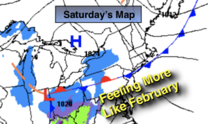
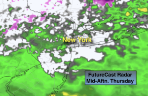
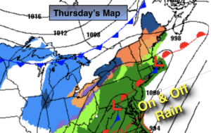
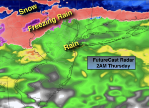
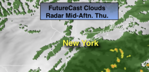
A low will develop over South Thursday and move North and East. The track is still up in the air, but the way this Winter has been going, the trend is your friend. At this time, the forecast is for a track to the West. This will result in rain. Stay Tuned.
Keep it here for a no nonsense, no hype forecast.
Today:
Clouds to some sun. Highs in the lower to mid 40s. East to South winds 5-10mph.
Tonight:
Thickening clouds with showers developing toward midnight. Lows around 40º in the City, the 30s inland. South winds at 5-10mph.
Monday:
Mostly cloudy with scattered showers. Highs near 50º.
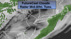
Tuesday:
Mostly cloudy. Showers are possible. Highs in the mid 40s.
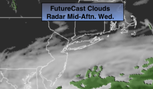
Wednesday:
Mostly sunny. Highs in the mid 40s.
Thursday:
Cloudy with a chance of rain. Highs in the mid 40s.