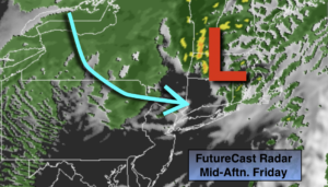
Synopsis:
An intensifying storm will move from Eastern PA to Southern New England today. Skies will be cloudy this morning with areas of fog. Showers will return by mid to late morning. Temperatures will spike for a few hours from the City and the South and East into the 50s to near 60º as the warm sector moves North. As the storm moves away from the region very strong West winds will develop from late morning through mid afternoon. Gusts between 45-60mph are possible. The highest wind gusts look to be South and East of the City. Isolated power outages and downed trees are possible.
The sun will make an appearance this afternoon. Readings will start off mild but temperatures will fall during the afternoon as colder air rushes in.
The weekend looks decent for February standards. Saturday will be tranquil and cool under a mix of sun and clouds. A few flurries are possible Sunday morning, otherwise skies will be partly sunny.
A weak system will move in from the West on Monday. Showers are possible. There’s just no cold air to support snow.
Tuesday will be partly sunny with above average readings.
Stay Tuned.
Keep it here for a no nonsense, no hype forecast.
Today:
Cloudy this morning with scattered by mid to late morning. Winds will increase dramatically toward midday. A mix of clouds and sun is expected for this afternoon. Very windy through mid-afternoon. Highs in the 40s well North and West to the 50s to near 60º closer to the coast. Temperatures falling during the afternoon. Southeast winds becoming West at 15-30mph with gusts 45-60mph.
Tonight:
Clear skies and much colder. Winds will begin to diminish. Lows in the upper 20s in the City, near 20º inland. West winds at 15-30mph and diminishing.
Saturday:
Partly sunny. Highs around 40º.
Sunday:
Early flurries, otherwise becoming partly sunny. Highs around 40º.
Monday:
Mostly cloudy with scattered showers. Highs in the upper 40s.
Tuesday:
Partly sunny. Highs in the mid 40s.