Synopsis:
A cool front has pushed South of the region. Any early morning showers at the coast will move offshore. Clouds will break for times of sun, especially North and West. Readings will be more near the seasonal average of 40º.
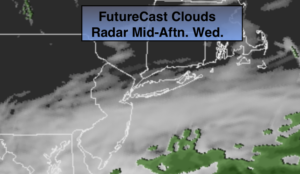
Tonight will be cloudy. The front will stall along the East coast and waves of low pressure ride up the coast. It maybe cold enough as high pressure noses in from Eastern Canada late tonight and Thursday morning for rain to start off as freezing rain or sleet North and West. Rain will fall along the coast and along the urban corridor Thursday. The rain will taper off during the late morning and much of the midday and afternoon hours should be dry.
On Friday as the second wave of low pressure moves North more rain is likely. The rain will taper off during the mid-day hours from West to East and some sun should return during the afternoon.
Saturday will be tranquil and cool under a mix of sun and clouds. A weak area of low pressure will move South of the region Saturday night and Sunday morning. At this time it doesn’t look like a big deal. Flurries are in the forecast.
Stay Tuned.
Keep it here for a no nonsense, no hype forecast.
Today:
Clouds will give way to some sun, especially North and West. Cooler. Highs in the lower 40s. North to Northeast winds at 5-10mph.
Tonight:
Rain developing toward midnight. Sleet and freezing rain likely inland. Lows in the mid 30s in the City, around freezing inland. East winds at 5-10mph.
Thursday:
Periods of rain. Sleet and freezing rain possible for a time North and West in the morning.The rain will taper off midday. Highs in the 30s well inland near 50º at the coast.
Friday:
Warmer. Morning rain, possibly heavy, will give way to partly sunny skies during the afternoon. Highs in the lower 50s.
Saturday:
Partly sunny. Highs around 40º.
Sunday:
Early flurries, otherwise becoming partly sunny. Highs around 40º.