Synopsis:
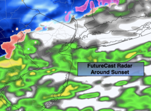
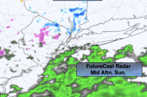
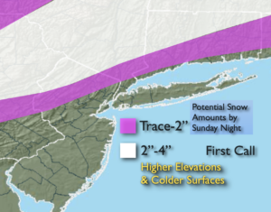
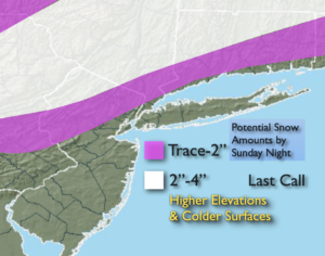
The second half of the precipitation event with the coastal low will occur tonight. On and off rain is expected for two thirds of the region .Any snow/sleet that potentially may accumulate, will occur over the higher elevations and on colder surfaces. This continues to look like a minor snowfall for inland areas (last call map above). The precipitation will become light and intermittent after midnight.
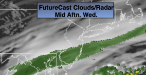
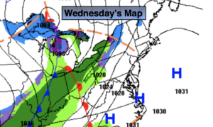
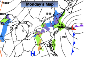
The work and school week looks quiet as low pressure moves to the Canadian Maritimes and high pressure settles in over the central and Eastern part of the nation. Readings will be just above average (average is 39º). It looks like the clouds will dominate through Tuesday as plenty of moisture will stick around. The wind will become busy Wednesday but finally mix up the atmosphere enough to allow for more sunshine.
Thursday and Friday will be bright, but tolerable.
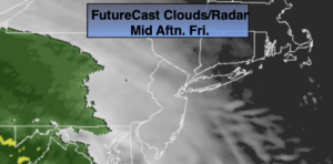
All of the computer models have a storm developing off the Carolina coast later Friday into Saturday. The track looks far enough South and East to not affect the tri-state area at this time. This is not etched in stone. There is cold high pressure available. Please check back with JMW for the very latest.
Stay Tuned.
Keep it here for a no nonsense, no hype forecast.
Tonight:
Areas of rain, sleet and light snow ending late late. Lows in the mid 30s in the City, around freezing inland. Northeast to North winds at 5-10mph.
Monday:
Mainly cloudy.. Highs in the mid 40s. North winds at 5-10mph.
Tuesday:
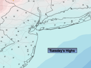
Mostly cloudy. Highs in the lower to mid 40s.
Wednesday:
Partly sunny. Breezy. Highs in the lower to mid 40s.
Thursday:
Mostly sunny. Highs in the lower to mid 40s.
Friday:
Partly sunny. Highs in the lower 40s.