Synopsis:
High pressure over the Western Atlantic will be stationary for the next several days. This will result in increasing heat and humidity and most likely result in a heatwave starting Monday.
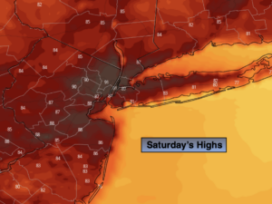
Today will start off with areas of clouds and fog, otherwise hazy sunshine is expected. You’ll notice an increase in the temperatures. Readings will be several degrees above the seasonal averages (the lower to mid 80s).
Tonight will be warm and muggy with lows remaining in the 70s throughout.
The 3 H’s will be with us through midweek as a typical Summertime pattern continues with a persistent Southwest wind around Atlantic high pressure. This will result in a heatwave. The combination of high temperatures and humidity will result in a heat index of 98º-104º Monday through Wednesday.
A cool front will approach on Thursday will some relief from the high heat. Cooling scattered thunderstorms will be moving through.
Stay tuned.
Keep it here for a no nonsense, no hype forecast.
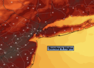
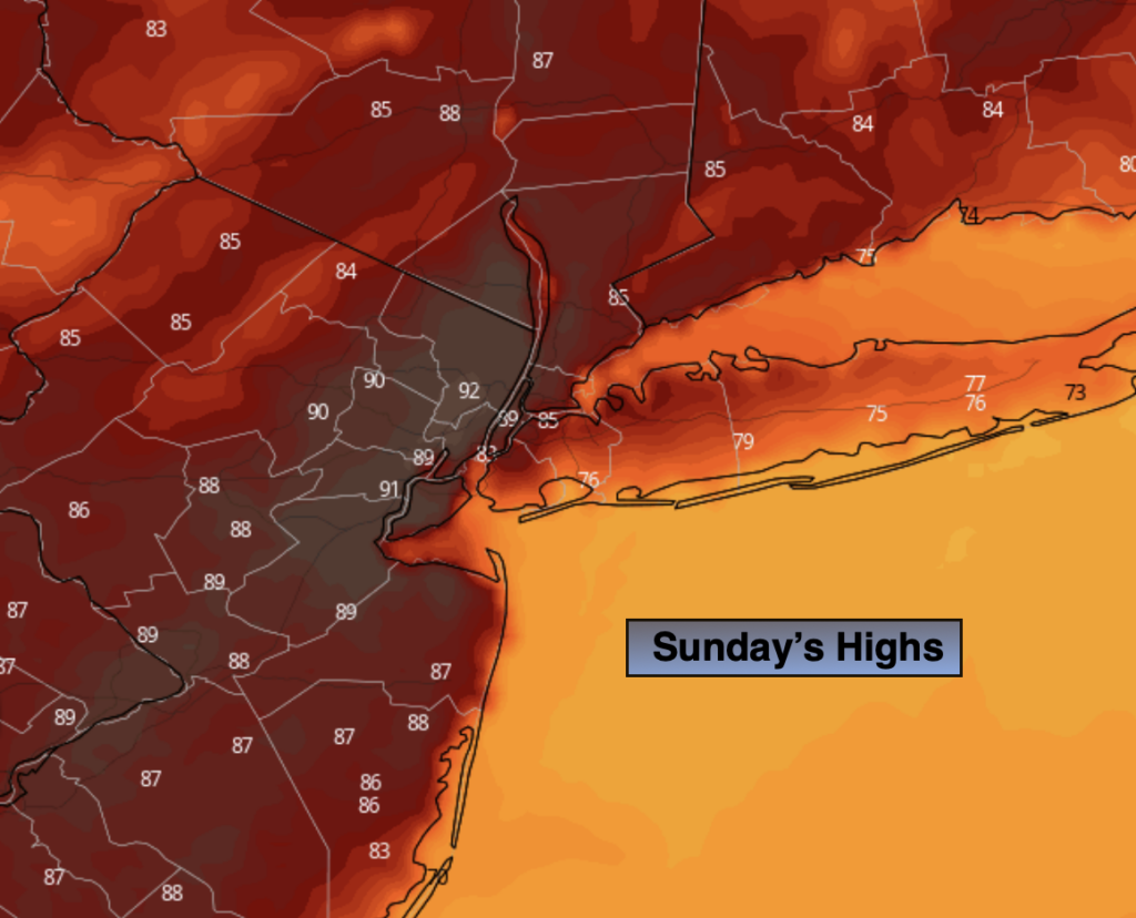
Sunday:
Morning clouds will give way to hazy sun, very warm and humid conditions. Highs in the upper 80s. Cooler at the coast. South to Southwest winds at 8-15mph.
Tonight:
Partly cloudy with patchy fog. Warm. Lows in the 70s throughout. South to Southwest winds at 5-10mph.
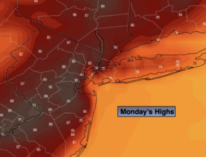
Monday:
Hazy, hot and humid. Highs in the lower to mid 90s. Heat index: 98º-104º.
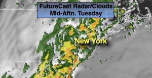
Tuesday:
3 H’s. Highs in the lower to mid 90s. Heat index: 98º-104º.
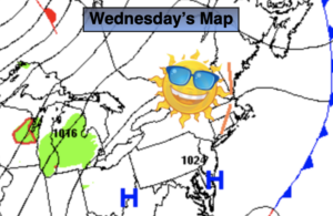
Wednesday:
3 H’s. Spot PM storm. Highs in the lower to mid 90s. Heat index: 98º-104º.
Thursday:
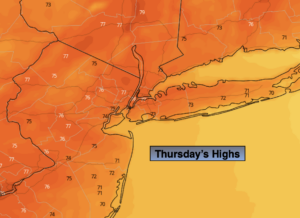
Mostly cloudy with scattered storms. Not as hot, but still humid. Highs in the mid to upper 80s.