Synopsis:
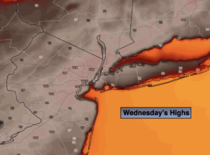
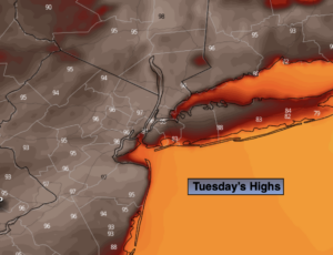
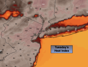
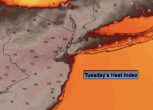
High pressure over the Western Atlantic will bring up a tropical airmass for much of the week. Hot & hazy conditions are expected Tuesday and Wednesday. The combination of temperatures in the 90s and high humidity will bring the heat index to over 100º+ in many areas. A Heat Advisory has been posted for much of the I-95 corridor. It will be cooler both days at the coast.
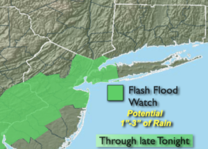
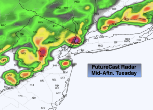
Scattered evening storms are likely today. Some of the storms may turn severe. Scattered late day storms are possible on Wednesday.
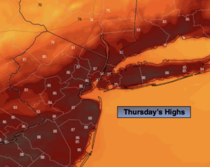
On Thursday, a weakening cool front will approach with a chance of showers and storms. This also bring some relief from heat.
Tropical Storm Elsa is forecast to move up and off the coast on Friday. The exact track of Elsa will determine how much rain, if any will fall. There shouldn’t be an issue with wind. High surf is a definite.
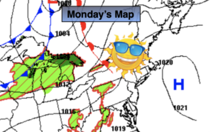
By Saturday, high pressure will build in. This will result in mainly sunny skies and warm temperatures.
Stay tuned.
Keep it here for a no nonsense, no hype forecast.
Today:
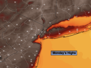
Hazy, hot and humid. Highs in the mid 90s. Cooler at the coast. Scattered evening storms. Heat index: 98º-104º. Southwest winds at 10-20mph with higher gusts.
Tonight:
Scattered evening storms, otherwise partly cloudy, very warm and muggy. Lows in the mid to upper 70s in the City, the upper 60s inland. Southwest winds at 5mph.
Wednesday:
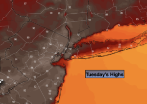
Hazy, hot and humid. Spotty PM Storm. Highs in the lower to mid 90s.
Thursday:
Warm and humid with scattered afternoon showers and storms. Highs in the mid 80s.
Friday:
Morning showers are possible, otherwise expected a mix of sun and clouds. Highs in the mid 80s.
Saturday:
Mostly sunny and warm. Highs in the mid 80s.