Synopsis:
Location will make all the difference in the world to what your temperature will be and how much rainfall your area will receive the next 24 hours. A warm front will be draped across the region. North of the front it will be more comfortable. To the South of the front it will be very uncomfortable with heat and high humidity
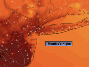
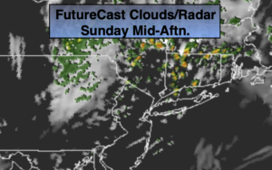
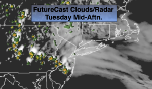
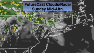
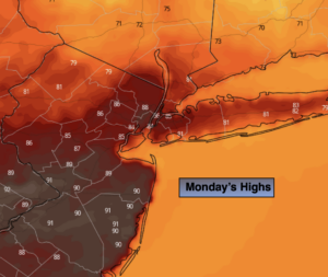
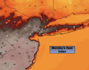
Today will feature a mix of clouds and sun. It’ll be tropical from the City and to the South. The heat index will get over 100º over Central and Southern NJ. To the North it’ll be more comfortable (maps above). Areas of rain well North of the City during the morning will taper off. Scattered showers and storms will develop during the mid afternoon.
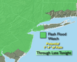
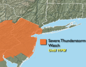
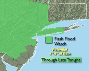
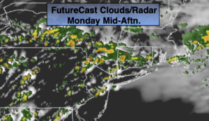
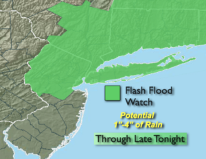
Unfortunately, the threat of torrential rains exists for much of the tri-state area for this evening and overnight. The front will remain over the region and thunderstorms are forecast to train over the same areas. These regions got hit with flooding rains a few days ago and heavy rain last night. The ground is completely saturated. Locally up to three inches of rain is possible in the tropical airmass. A Flash Flood Watch is up for much of the region for later today and tonight. Never drive through a flooded roadway; you can’t judge how deep the water is. TURN AROUND, DON’T DROWN.
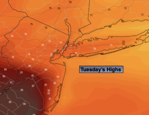
A cooler flow off the Atlantic will be with us for Tuesday. A mix of clouds and sun is expected. Readings will be several degrees below the average high of the mid 80s.
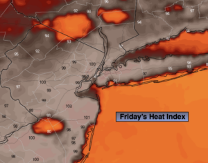
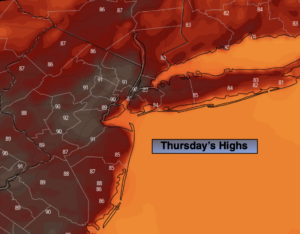
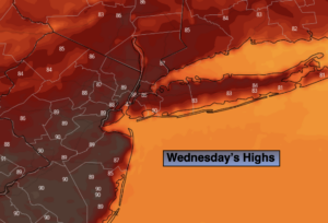
The heat will return for the mid to late week period as a bubble of hot air develops around a Western Atlantic high pressure system. Hazy skies are expected with isolated afternoon storms possible on Wednesday. Thursday and Friday will be hot and humid and mainly storm-free.
Stay tuned.
Keep it here for a no nonsense, no hype forecast.
Today:
Areas of morning fog, otherwise clouds than sun. Hot and humid from the City and to the South. More comfortable to the North. Scattered afternoon storms. Highs in the mid to upper 80s around the City, the lower 90s to the South, the lower 80s to the North. Winds will be light and variable.
Tonight:
Showers and thunderstorms. Areas of torrential rain. Lows in the lower 70s in the City, the upper 60s inland. East to Northeast winds at 5mph.
Tuesday:
Partly sunny. Not as warm, moderately humid with spotty afternoon storms. Highs around 80º.
Wednesday:
Hazy, very warm and humid with spotty afternoon storms. Highs in the upper 80s.
Thursday:
Hazy, hot and humid. Highs around 90º.
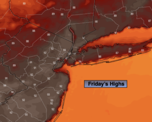
Friday:
Hazy, hot and humid. Highs in the lower 90s.