Synopsis:
The last weekend of Summer is looking fantastic. Today will be feature mainly sunny skies. From time to time clouds will roll in and an isolated shower can’t be ruled out. 95% of the day will be dry. Sunday will be the sunnier day of the weekend. The humidity will come way down. It’ll be a gem.
Seasonal, sunny days are expected into the mid week as strong high pressure remains in control. We’ll turn the page from Summer to Autumn on Wednesday.
Stay tuned.
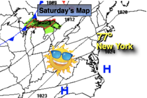
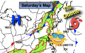
Saturday:
Sun, some clouds. An isolated shower. Warm. Highs in the lower to mid 80s. North to Northwest winds at 5-10mph.
Tonight:
Clear and comfortable. Lows in the mid 60s in the City, the 50s inland. North to Northwest winds at 5-10mph.
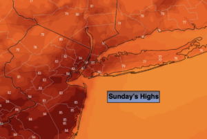
Sunday:
Sunny. Much less humid. Highs in the upper 70s.
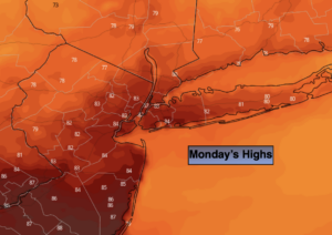
Monday:
Mostly sunny. Highs in the mid to upper 70s.
Tuesday:
Mostly sunny. Highs in the mid 70s.
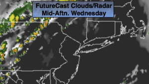
Wednesday:
Partly sunny. Highs in the mid to upper 70s.