Synopsis:
The jet stream, the river of air that guides our weather systems, is coming out of the West and Northwest and not the Southwest or South. This will result in a hiatus from the high heat and humidity of late. Tolerable conditions are expected through the week under a mix of sun and clouds.
As it looks right now, there are two small threats of precipitation the next five days. A weak cool front will approach on Wednesday with scattered afternoon storms. Scattered afternoon showers are possible on Friday with upper level energy working through.
Finally, a well deserved break from the heat, humidity, torrential rains and storms. It’s been one crazy July so far.
Stay tuned.
Keep it here for a no nonsense, no hype forecast.
Today:
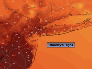
Partly sunny. Highs in the lower to mid 80s. Northwest winds at 5-10mph.
Tonight:
Mostly clear. Lows in the lower 70s in the City, the 60s inland. West winds at 5mph.
Tuesday:
Partly sunny. Highs in the upper 80s.
Wednesday:
Partly sunny. Chance of a late day storm. Highs in the mid to upper 80s.
Thursday:
Mostly sunny. Highs in the mid 80s.
Friday:
Sun and clouds. Chance of afternoon showers. Highs in the mid 80s.