Synopsis:
Another shot of bitter air will make a visit and stick around through Thursday courtesy of high pressure from the North. Skies will be sunny both days with frigid overnight lows.
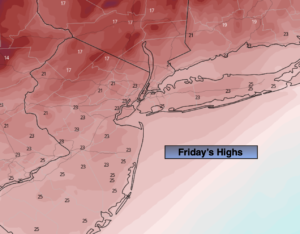
A moderation in temperatures is expected for Friday under partly sunny skies. We’ll crack freezing.
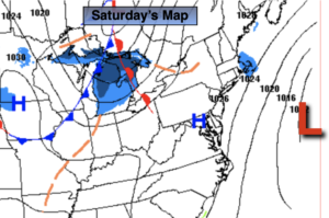
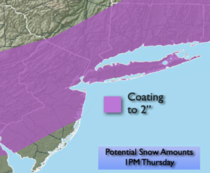
A deepening area of low pressure will be moving up and off the Mid-Atlantic and Northeast coast on Saturday. The potential is there for snow and wind. The exact track (as always) will determine what areas may get into the heavier snow. There is also the possibility of high winds and coastal flooding. This will be an intense storm off the coast. Again, nothing is etched in stone. Please keep it here for no hype, no nonsense forecast. JMW will have more details on the storm later today.
Sunday will be windy and very cold with mainly sunny skies.
Stay tuned..
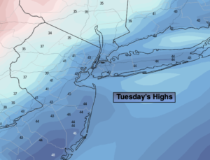
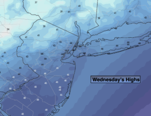
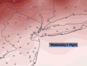
Wednesday:
Mostly sunny. Cold. Highs in the mid to upper 20s. Northwest winds at 10-20mph.
Tonight:
Clear and frigid. Lows in the mid teens in the City, single digits inland. Light North winds.
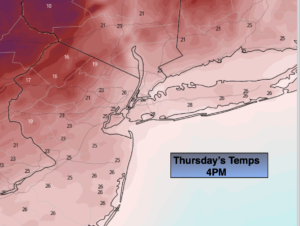
Thursday:
Sunny and cold. Highs in the lower 30s.
Friday:
Sun will give way to increasing and thickening clouds. Highs in the mid 30s.
Saturday:
Potential for snow and wind. Highs only in the 2os.
Sunday:
Mostly sunny, wind and cold. Highs only in the mid 2os.