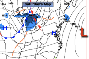
Synopsis:
BLIZZARD WARNING for Monmouth, Ocean and Suffolk counties for through Saturday.
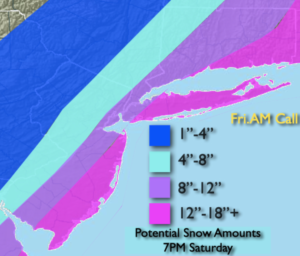
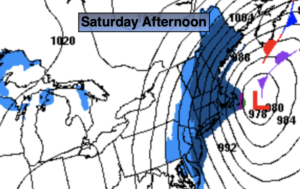
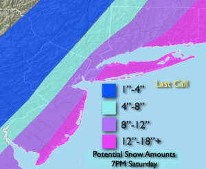
The deepening area of low pressure will be moving up and off the Mid-Atlantic and Northeast coast today. The snow will be heavy at times along and to the South and East of I-95. The exact track (as always) will determine how far West the heavy snow bands will get. There will be a sharp cutoff to the heavy snow to the North and West of the City. This will be the possible “Bust Zone”. If the storm track is farther East, lighter accumulations will occur. If the track is closer to the coast this area will also receive a significant snowfall. The map above is the “Last Call” potential snowfall by 7pm Saturday. Please keep it here for no hype, no nonsense forecast. The snow will wind down from Northwest to Southeast during the late morning through the late afternoon depending on your location.
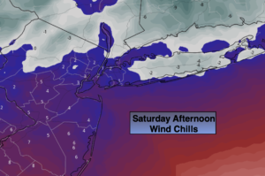
This will be an intense storm off the coast. Today will feature strong winds, falling temperatures, blowing snow and dangerous winds chills near 0º or below in spots. It will be difficult to be outdoors. Coastal flooding is also possible at the times of high tide Saturday Morning. Blizzard conditions are expected for Monmouth, Ocean and Suffolk counties for heavy snow, winds over 35mph and very low visibility. These conditions need to be met for 3 consecutive hours (this will happen).
Sunday will be windy and very cold with mainly sunny skies.
More tranquil conditions will be with us for the beginning of next week.
I will be on Fox Weather today (Saturday) from 1-7pm. Catch me there! Stay safe and I hope you’re all stocked up!
Stay tuned.
Saturday:
Snow. Heavy at times closer to the coast. Snow tapers off from West to East midday to mid-afternoon. Windy. Highs only in the teens and lower 20s. Wind chills near 0º. North to Northwest winds at 15-30mp with gusts to 45mph.
Tonight:
Clearing. Frigid. Winds will begin to diminish. Lows around 13º in the City, the single digits inland. Northwest winds at 15-25mph with gusts to 30mph and diminishing.
Sunday:
Mostly sunny, wind and cold. Highs only in the mid to upper 2os.
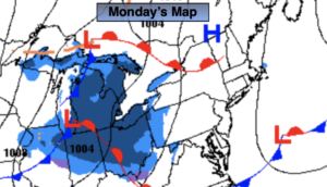
Monday:
Sunny. Highs in the mid 30s.
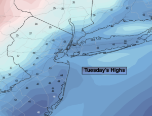
Tuesday:
Mostly sunny. Mild. Highs around 40º.
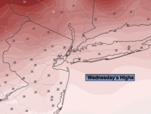
Wednesday:
Partly sunny. Milder. Highs in the mid 40s.