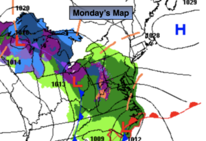
Synopsis:
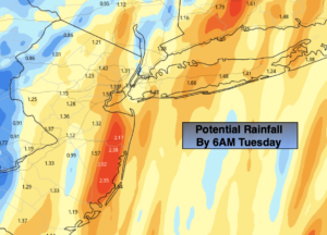
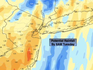
Low pressure will move up the Eastern seaboard tonight and intensify as it does. Rain will develop during the evening hours and become steady and heavy. One to two inches of rain is possible. Along with the rain will come an increasing Northeast wind. Winds could gust up to 45mph along the coast overnight. This storm will last about 8 hours.
The storm will move into Eastern New England on Tuesday. Morning clouds will give way to sunny skies. It will still be chilly.
Wednesday will be bright and pleasant as high pressure builds overhead. Pleasant conditions will continue into Saturday as high pressure remains in control.
Stay tuned.
Keep it here for a no hype, no nonsense forecast.
Tonight:
Rain, heavy at times. Windy. Lows around 40º in the City, the upper 30s inland. Northeast winds at 15-30mph with gusts to 45mph along the coast.
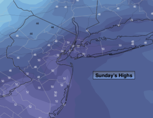
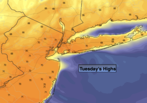
Tuesday:
Partly sunny breezy and chilly. Highs in the mid 50s. West winds at 15-25mph with higher gusts.
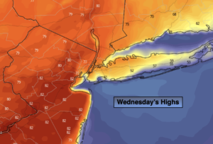
Wednesday:
Sunny. Highs around 60º.
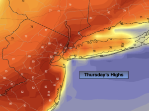
Thursday:
Partly sunny. Highs in the lower 60s.
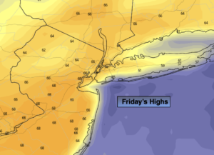
Friday:
Mostly sunny. Milder. Highs in the upper 60s.
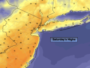
Saturday:
Partly sunny. Highs in the lower 60s.
Catch me on the Fox Business Network this weekend from 6am-9am and on the Fox Weather Stream until Noon. Find us on the stream on Tubi, Roku TV and YouTube TV and as always the Fox Weather App. It’s Free!