Synopsis:
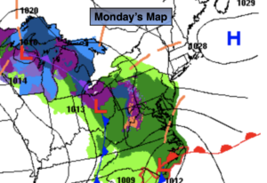
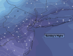
Monday will be pleasant under a mix of sun and clouds as high pressure slips off the coast. Winds will continue to blow off the colder Atlantic this will continue our below average temperatures. The average high is 66º. We’ll be several degrees below that number. If you noticed, it felt much cooler in shaded areas the past several days but once you got into that strong April sun it felt much better.
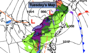
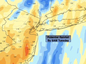
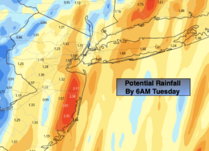
A cold front will approach Tuesday. Scattered showers are likely. It will not be a washout.
More sunshine is expected for Wednesday; it’ll be cool and breezy as a Canadian filters in. Chilled sunshine will be with us through the end of the week as the Northwesterly flow will be persistent.
Stay tuned.
Keep it here for a no hype, no nonsense forecast.
Monday:
Sun and clouds. Highs in the lower 60s. East to Southeast winds at 5-10mph.
Tonight:
Becoming mostly cloudy. Lows in the 40s throughout. Light Southeast wind.
Tuesday:
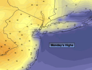
Mostly cloudy with scattered showers. Highs in the lower to mid 60s.
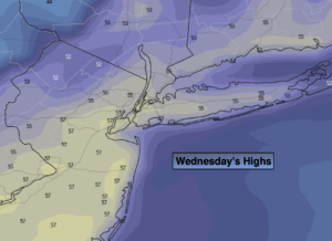
Wednesday:
Partly sunny, breezy and cool. Highs in the mid to upper 50s.
Thursday:
Mostly sunny and cool. Highs in the mid to upper 50s.
Friday:
Mostly sunny. Highs around 60º.
Catch me on the Fox Business Network this weekend from 6am-9am and on the Fox Weather Stream until Noon. Find us on the stream on Tubi, Roku TV and YouTube TV and as always the Fox Weather App. It’s Free!