
Synopsis:
The remnants of Ida will affect our region through late tonight.
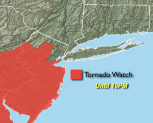
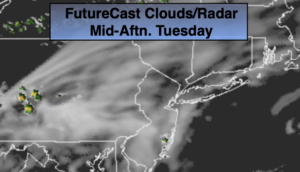
On and off rain is likely today. A steadier rain is likely North and West of the City. Southern areas will likely see the least amount of rain through the afternoon. Steadier and heavier rain is likely toward evening for all areas. A few thunderstorms are possible and I will be keeping my eye on the possibility of severe storms over central and Southern areas of the tri-state for later today and this evening. The brunt of the storm will be Wednesday evening through the wee hours of Thursday morning with areas of torrential rain.
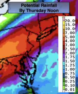
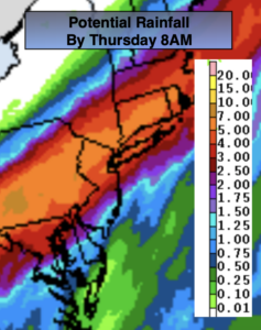
As you can see by the potential rainfall map above there will be a heavy axis of flooding rains for the Northern two thirds of our region. 2″-6″+ of rain is possible. Needless to say, we do not need anymore rain. The grounds are saturated and rivers and streams remain high. The potential for flooding is high. A Flash Flood Watch is in effect for the entire region. Flooding of streets, basements, streams and main stem rivers is at a high potential. Never drive through a flooded roadway you don’t know how deep the water is. TURN AROUND, DON’T DROWN.
The storm will pull out of the area on Thursday morning. Rain will end by sunrise and it will be a bright, cool and breezy September day. Readings will be close to ten degrees below the average high of the lower 80s.
Friday will be a gem as cool high pressure influences the region. Abundant sunshine is expected with low humidity.
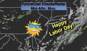
The Labor Weekend will make most smile! High pressure will dominate resulting in mainly sunny skies and comfortable readings.
Keep it here for a no nonsense, no hype forecast.
Stay tuned.
Wednesday:
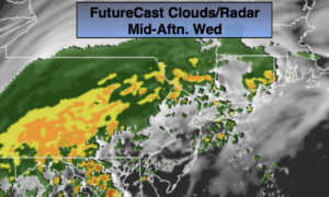
Cloudy with on and off rain. The steadiest rain will be North of the City during the day. Parts of central and Southern NJ will only experience scattered showers. Widespread heavier rain and scattered thunderstorms South of the City, will move in by late afternoon into the evening. Much cooler. Highs in the lower to mid 70s.
Tonight:
Areas of torrential rain and thunderstorms. Much cooler. Lows in the lower 60s in the City, the upper 50s inland. Northeast to North winds at 15-25mph.
Thursday:
Becoming partly sunny and breezy. Cool. Highs in the lower 70s.
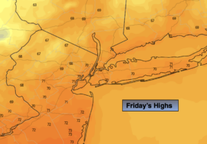
Friday:
Sunny. Highs in the mid 70s.
Saturday:
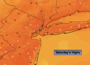
Sunny. Highs in the mid to upper 70s.
Sunday:
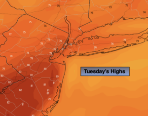
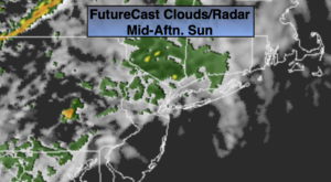
Partly sunny. Highs around 80º.