Synopsis:
Conditions through the end of the week will be dominated by stalled low pressure the Northeast. This will result in a persistent Northwest Flow. Because of this, temperatures will be below average for today and Friday. The average highs are in the mid to upper 70s. Clouds and some sun are expected through this timeframe. By Friday, the low will pivot to Southern New England. The will result in mainly cloudy skies with the chance of showers later in the day.
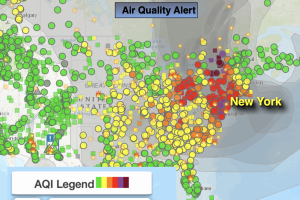
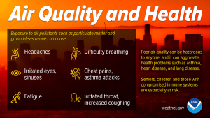
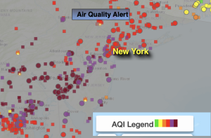
Smokey conditions will continue for today from the wildfires in Quebec. An Air Quality alert has been issued for much of the tri-state area. Those with respiratory issues should limit time outside. The smoke will make for a spectacular sunrise and sunset. What was truly amazing was the smell from the fires. I have never experienced that. Crazy to say the least.
Significant rainfall is not likely during the next 5 days. We desperately need rain. Any spotty showers Friday will not help the deficit.
By the weekend, the low will finally weaken and move out to sea. Mainly sunny skies are expected as a ridge of high pressure works into the region. Temperatures will be in near seasonable averages.
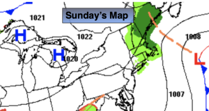
Scattered showers are possible on Monday as a front approaches from the West.
Stay tuned.
Keep it here for a no nonsense, no hype forecast.
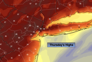
Thursday:
Smokey skies. Clouds and sun. Cool. Highs around 70º. Northwest winds at 5-10mph.
Tonight:
Mostly cloudy. Lows in the mid to upper 50s in the City, the 40s and 50s inland. Light Winds.
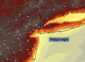
Friday:
Mostly cloudy. Spotty late day and evening showers. Cool. Highs in the 60s to around 70º.
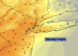
Saturday:
Mostly sunny. Milder. Highs in the mid 70s.
Sunday:
Mostly sunny. Warmer. Highs in the lower 80s.
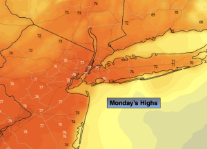
Monday:
Sun and clouds. Afternoon showers possible. Highs in the mid 70s.