Synopsis:
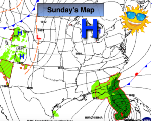
Warm and humid conditions are expected this last weekend of Summer as high pressure dominates. A spotty storm is possible into this evening as a weak upper level unit of energy works through. Most areas will be rain free. Sunday will start off with areas of fog but the sun will return.
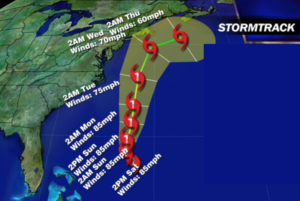
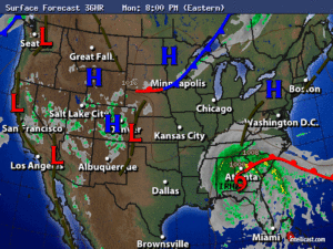
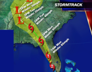
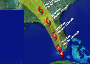
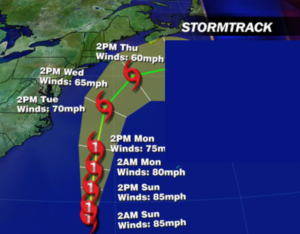
Hurricane Jose is between Bermuda and the US and moving Northwest. Will it eventually affect the East coast? Most of the models now have come to a consensus that the hurricane will ride North-parallel and up off the coast through next week (NHC map above). The potential of coastal showers and gusty winds are in the forecast for later Tuesday into Wednesday. High surf, rip currents and beach erosion is a likely to matter what the eventual track is. As we all know, the track can change. Affects from Jose will most likely be felt but a direct hit at this time is unlikely. As with any tropical system; I NEVER let my guard down until the storm is North of our latitude.
This is the peak of hurricane season and a few more named storms maybe on the way in the very near future.
Stay Tuned.
Tonight:
Partly cloudy with a spotty evening shower or storm. Lows in the upper 60s in the City, the lower 60s inland. Southeast to Northeast winds at 5mph.
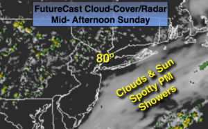
Sunday:
Areas of morning fog otherwise becoming partly sunny. Humid. A stray afternoon shower is possible. Highs around 80º. Southeast to Northeast winds at 5-10mph.
Monday:
Partly sunny. Highs around in the upper 70s.
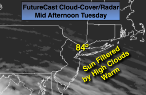
Tuesday:
Mostly cloudy and becoming windy. Showers are possible, especially at the coast. Highs around in the mid 70s.
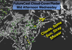
Wednesday:
Mostly cloudy and windy. Showers are possible, especially at the coast. Highs around in the mid to upper 70s.
Thursday:
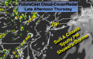
Partly sunny and warm. Highs around 80º.
Keep it here for a no nonsense, no hype forecast.