Synopsis:.
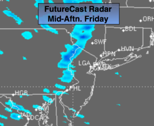
Cold high pressure will slowly move into the region through Saturday under a mix of sun and clouds. An Arctic front may spark off flurries or snow squalls later this afternoon (FutureCast radar above). If a snow squall moves over your region a burst of heavy snow and highs winds is possible. It will only last a few minutes, but a whitening of the ground is possible. Saturday and Sunday’s lows will be bone chilling with readings in the teens and single digits.
By Sunday afternoon temperatures will rebound to just below seasonal readings with high pressure overhead. Warmer times will be on the way for the beginning of next week as another Spring Fling will be upon us.
Today:
Sun will give way to clouds. Breezy and colder. Scattered late day flurries or snow squalls are possible. Highs around 40º. West to Northwest winds at 15-25mph with gusts to 30mph.
Tonight:
Mostly clear and much colder than recent nights. Lows around 20º in the City, the teens inland. Northwest winds at 15-25mph with gusts to 35mph. Wind chills by morning will be in the single digits.
Saturday:
Mostly sunny and cold. Highs in the mid 30s. The average high temperature is 46º.
Sunday:
Sunny. Highs in the upper 30s to lower 40s.
Monday:
Partly sunny. Mild once again. Highs in the lower to mid 50s.
Tuesday:
Sunshine followed by clouds. Late afternoon showers are possible. Highs around 60º.
Stay Tuned.
Keep it here for a no nonsense, no hype forecast.