Synopsis:
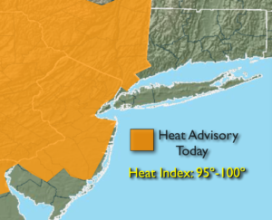
Today will be sizzling with readings reaching the lower to mid the 90s as a hot bubble of air moves in from the Midwest. The humidity will be higher than recent days. The record for Central Park is 95º; it’ll be close. A Heat Advisory has been posted for much of NJ and NY state, North of the City. The combination of readings in the 90s and high humidity will make the heat index approach 95º-100º. Please drink plenty of water, take it slow and listen to your body.
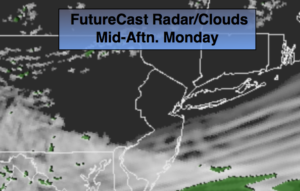
A cool front will approach tonight with a spot storm. Tuesday will still be hot but the humidity will be much lower. Mostly sunny skies are expected.
An end to the early season heat will arrive by Wednesday much more comfortable conditions.
Summer arrives on Thursday. The change of season promises not to disappoint.
Stay tuned.
Today:
Hazy, hot and humid. Highs in the lower to mid 90s. An isolated late day storm is possible. Most areas will be dry. Heat index: 95º-100º. Southwest winds at 10-20mph.
Tonight:
Mostly cloudy with spotty thunderstorms. Warm and humid. Lows in the 70s throughout. Southwest to West winds at 8-12mph.
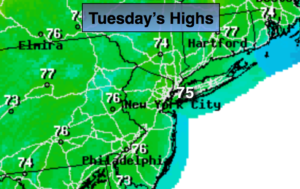
Tuesday:
Mostly sunny. Hot, but much less humid. Highs around 90º.
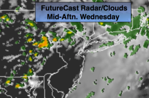
Wednesday:
A mix of sun and clouds. Highs in the lower to mid 80s.
Thursday:
Mostly sunny and warm. Highs in the mid 80s.
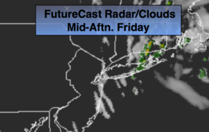
Friday:
Sunny and warm. Highs in the lower to mid 80s.
Keep it here for a no nonsense, no hype forecast.