Synopsis:
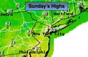
Some of the finest weather for August will be with us through the weekend. High pressure will remain along the East coast. Mostly sunny skies and low humidity is expected through today. Temperatures will be near the average high of 82º.
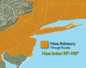
The high will slip off the coast Monday and strengthen. This will result in return flow and bring up hot bubble of air from the South and West. Readings on Monday should crack the 90º mark and this very well could be the start of a late Summer heatwave. The humidity will also rise to uncomfortable levels. The combination of high temperatures and high humidity will cause the heat index to be 100º or higher, especially on Tuesday and Wednesday. The heat should break by Thursday.
Stay tuned.
Today:
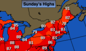
Mostly sunny. Highs in the lower to mid 80s. Southwest wind at 8-12mph.
Tonight:
Mostly clear. Lows in the lower 70s in the City, the 60s inland. Light Southwest wind.
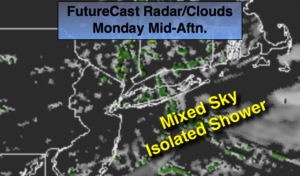
Monday:
Hazy, hot and humid. Highs around 90º. Heat Index in the mid 90s.
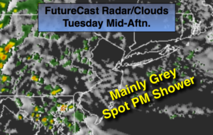
Tuesday:
Hazy, hot and humid. Highs in the lower to mid 90s. Heat index: 98º-104º.
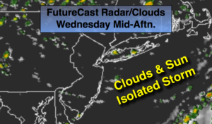
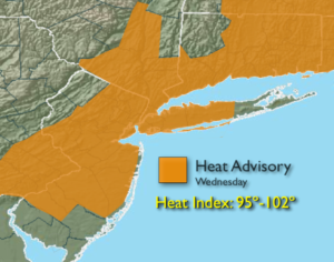
Wednesday:
Hazy, hot and humid. Highs in the lower to mid 90s. Heat index: 98º-104º.
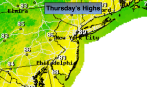
Thursday:
Partly sunny, not as hot or humid. Highs in the mid to upper 80s.
Keep it here for a no nonsense, no hype forecast.