Synopsis:
An upper level low and weak low pressure at the surface will be sluggish to move off the East coast through Wednesday. This will result in times of showers, storms and some sun. It will not be a washout and a good part of the time will be dry.
This system will move off the coast Wednesday night allowing for weak high pressure to move in by week’s end. Plenty of sun and warm to hot readings can be expected Thursday and Friday.
I’ll be on Hiatus the next several days. Enjoy the remaining days of Summer!
Today:
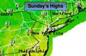
Clouds and some sun. Spotty showers and storms. Highs in the upper 70s to around 80º. Northeast winds at 5-10mph.
Tonight:
Mostly cloudy with scattered showers. Lows in the lower 70s in the City, the upper 60s inland. Light Northeast wind.
Monday:
Mostly cloudy with scattered showers and storms. Highs around 80º.
Tuesday:
Clouds and sun. Scattered showers and isolated storms. Highs in the mid 80s.
Wednesday:
Mostly sunny, much warmer. Highs in the upper 80s.
Thursday:
Mostly sunny and hot. Highs around 90º.
Keep it here for a no nonsense, no hype forecast.