Synopsis:
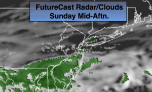
A weak wave of low pressure will move just South of the NYC area today. This will result in the majority of today being grey with scattered showers from the City and to the South. It will be very cool for this first full day of Fall. Autumn arrived yesterday at 9:54PM. The showers will taper off and push offshore later this afternoon. Some sun is possible, especially North and West as the day goes on.
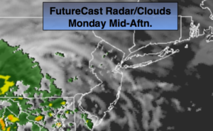
Monday will be dry and pleasant as strong high pressure over Eastern Canada influences the area. Readings will be a few degrees below the average of 72º under partly sunny skies.
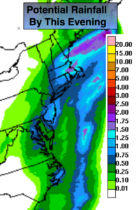
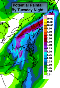
High pressure over the Canadian maritimes along with a trough of low pressure moving toward the East coast will result in periods of rain on Tuesday. By Wednesday, a cool front will approach the region with scattered showers. There will be dry times on Wednesday.
You know where to find a no hype, no nonsense forecast.
Stay tuned.
Today:
Mostly cloudy with scattered showers from the City and to the South. The sun will make an appearance during the afternoon from Northwest to Southeast. Coastal areas may not get to see any sun. Cool. Highs in the mid to upper 60s. Northeast winds at 5-10mph.
Tonight:
Becoming partly cloudy. Chilly. Lows in the upper 50s in the City, the upper 40s inland. Northeast winds at 5mph.
Monday:
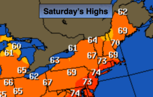
Partly sunny, cool. Highs in the 60s to around 70º.
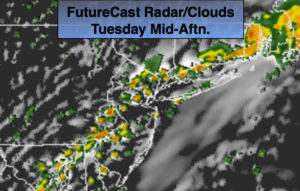
Tuesday:
Cloudy with periods of rain. Highs in the lower 70s.
Wednesday:
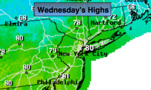
Clouds and sun. Warmer and more humid with scattered showers. Highs in the upper 70s.
Thursday:
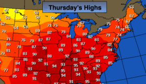
Partly sunny. Highs in the lower 70s.
Keep it here for a no nonsense, no hype forecast.