Synopsis:
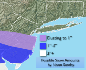
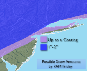
A disturbance will move in tonight and Friday morning from the west with scattered areas of light snow and rain. A coating to a couple of inches is possible by Friday morning, mainly from the City and to the North and West (map above). Any precipitation will end by mid-morning and the sun may make an appearance during the afternoon. It’ll be milder.
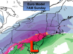
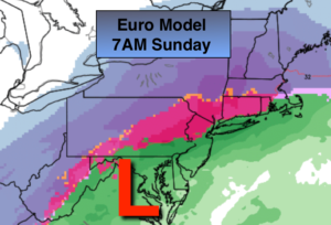
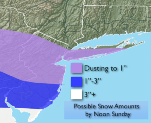
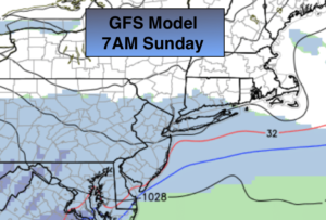
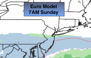
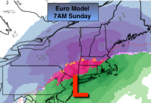
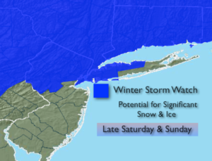
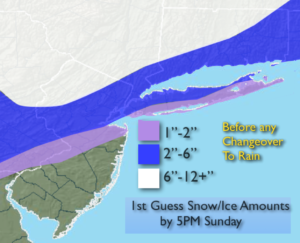
Now on to the weekend. The potential for a heavy precipitation event in the East continues, starting later Saturday and continuing into Sunday. A Winter Storm Watch is now in effect for Late Saturday Into Sunday for New York City, Northern NJ, Nassau & Northwestern Suffolk Counties, All of New York State and Connecticut. It should start as snow or a mix later Saturday afternoon or evening. An accumulating snow (a few to several inches depending on location) is possible just inland and including the City before a mix occurs Saturday night. The latest computer guidance continues to suggests a warm slug of air will work in changing the snow over the rain along the coast and freezing rain or rain inland. The European model (map above) is the latest update, it has nudged the frozen precipitation a tad to the North, again. It also has the storm just Southeast of NYC by Sunday morning. A slightly warmer scenario for the 6 hour period around sunrise. The shades of purple is where heavy snow is anticipated. The red area is the potential ice storm-the worst case situation, and the green is rain. The GFS continues with a warmer solution but looks to be coming around to the European idea. The NAM model is the outlier showing a heavy snowfall for much of the immediate area. I am discounting this model at this time .
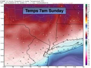
Flooding rains are possible where the precipitation stays liquid. There will be an incredibly tight thermal gradient along the East coast. A shift of 50 miles either way would be the difference between mostly rain or mostly snow and ice.
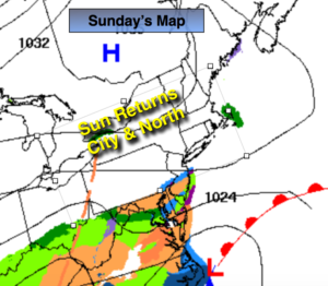
A flash freeze is likely on Sunday as the push of Arctic air works in. Any leftover precipitation may go over to a period of snow on Sunday with accumulations possible. It all depends on how quickly the Arctic air funnels in and how much precipitation is remaining. Some of the models rapidly end the precipitation by mid-day Sunday lessening the threat of accumulating snow with the sun even returning during the afternoon.
To recap: As of right now, it looks like a burst of moderate to heavy snow at the onset of the storm later Saturday and into Saturday night for much of the area. Several inches may accumulate around and to the North and West of the City. A mix over Southern sections. Then a transition to heavy rain along the coast with the potential of heavy freezing rain inland into Sunday morning. All areas have the chance to go back to snow during the day Sunday. This continues to be a fluid situation. JMW continues to monitor the latest information coming in.
You know where to find a no hype, no nonsense forecast.
Stay tuned.
Tonight:
Light snow developing later in the evening from West to East. A mix or rain to the South. Lows around freezing in the City, the 30s to the South, the 20s to the North. Southeast winds less than 5mph.
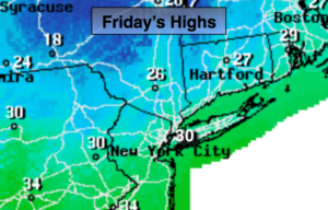
Friday:
Mostly cloudy with scattered rain or snow showers in the morning. Milder. Highs in the lower 40s. East to Northwest winds at 5-10mph.
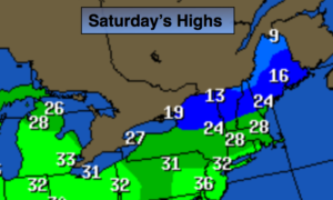
Saturday:
Morning sun will give way to thickening clouds. Snow will move in during the afternoon or evening. A mix is possible over Southern areas. Highs in the mid 30s.
Sunday:
Heavy rain along the coast and Southern areas. Heavy freezing rain and snow inland. The potential is there for all of the precipitation to go over to a period of snow during the day. Readings in the 20s, 30s & 40s depending on location. Temperatures will plummet to the teens and 20s later in the day.
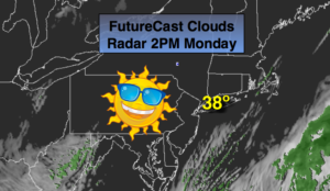
Monday:
Partly sunny, windy and bitterly cold. Highs only in the lower teens. Wind chills near 0º.
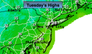
Tuesday:
Sunny and cold. Highs in the upper 20s.