Synopsis:
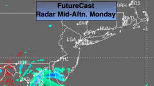
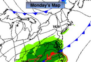
The workweek will be tranquil. An area of low pressure will slide to our South on Monday as a cool front pushes South of the region. A stray shower is possible but the majority of the day will be dry under a mix of sun and clouds. The best chance for showers will be South of the City later today and into this evening.
A large, strong high pressure system will move in for the rest of the week. A nice string of sunny days will be with us. Temperatures will be below average through midweek but then rise to above average late week.
Keep it here for a no nonsense, no hype forecast.
Today:
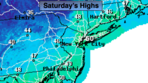
Clouds and sun. A stray shower is possible. A better chance of showers South of the City later today. Highs in the lower to mid 50s. North to Northwest winds at 5-10mph.
Tonight:
Showers possible this evening to the South, otherwise becoming partly cloudy. Lows around freezing in the City, the 20s inland. North winds at 5-10mph.
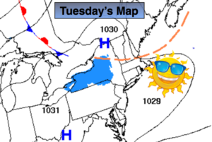
Tuesday:
Sunny. Cooler. Highs in the mid 40s.
Wednesday:
Sunny. Highs in the mid 40s.
Thursday:
Sunny. Highs in the lower 50s.
Friday:
Mostly sunny, much milder. Highs in the mid 60s.