Flash Flood Watch Into Tonight. Local Downpours. Humid…


Synopsis:

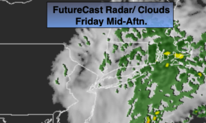
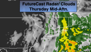
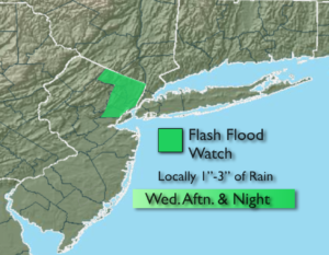
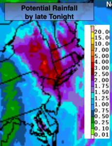
Tropical Storm Michael will move off the Virginia coast tonight at the same time a cold front will be moving through. On and off showers and thunderstorms are likely. Some of the rain maybe torrential at times. The front will draw up some tropical moisture from Michael as it moves off the Mid-Atlantic coast tonight. Micheal will miss the area but the combination of both factors mentioned above has prompted a Flash Flood Watch for much of the region through late tonight. One to three inches of rain is possible. The heaviest rain will fall along the Southern NJ coast & Eastern Long Island (1st map above). The rain taper off very early Friday morning with Eastern Long Island being the last to dry out by mid-morning. The sun will return Friday along with much cooler and less humid conditions. Temperatures will finally be near the average high of 66º.

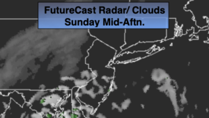
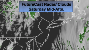
The weekend will be chilly with readings actually below average for a change. A few showers are possible Saturday morning with the sun returning during the afternoon. Sunday will be the better half of the weekend with plenty of sun as high pressure dominates.

You know where to find a no hype, no nonsense forecast.

Stay tuned.

Tonight:

Scattered showers with an isolated storm. Torrential rain at times. The heaviest rain will fall over coastal NJ later tonight. Much cooler and less humid by morning. Lows in the upper 50s in the City, the lower to mid 50s inland. Southwest to Northwest wind increasing to 15-25mph late.

Friday:

Early morning rain possible at the coast, otherwise becoming mostly sunny. Much cooler, breezy and less humid. Highs in the mid 60s.

Saturday:

Showers possible during the morning, otherwise becoming partly sunny. Very cool. Highs in the upper 50s.

Sunday:

Mostly sunny & cool. Highs around 60º.

Monday:

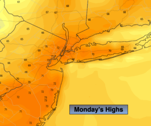
Early sun to afternoon showers. Highs in the mid 60s.

Tuesday:

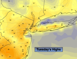
Partly sunny, chilly. Highs in the upper 50s.

Keep it here for a no nonsense, no hype forecast.


On & Off Showers/Storms Today. Local Downpours. Humid…


Synopsis:

Hurricane Michael made landfall yesterday afternoon just short of category 5 status (winds of 155mph) near Mexico Beach, Florida. Catastrophic damage has occurred. This was the strongest hurricane to hit the Florida panhandle since records have been kept. It’s also the 4th strongest hurricane in terms of sustained wind to hit the US and the 3rd most intense relating to low barometric pressure. Michael has weakened to a tropical storm will move through the Carolinas today and off the Virginia coast tonight.

A cold font will be approaching the region later today. On and off showers and thunderstorms are likely. Some of the rain maybe torrential at times. The front will draw up some tropical moisture from Michael as it moves off the Mid-Atlantic coast tonight. The storm will miss the area but the combination of both factors mentioned above has prompted a Flash Flood Watch for much of the tri-state area later Thursday and Thursday night. The heaviest rain will fall along the Southern NJ coast. The rain taper off very early Friday morning with Eastern Long Island being the last to dry out by mid-morning. The sun will return Friday along with much cooler and less humid conditions.

The weekend will be chilly with readings actually below average for a change. A few shower are possible Saturday. Sunday will be the better half of the weekend with plenty of sun.

You know where to find a no hype, no nonsense forecast.

Stay tuned.

Today:

Cloudy with on and off showers and storms. Local downpours. Humid. Highs in the mid 70s. South to Southwest winds at 5-10mph.

Tonight:

Scattered showers with an isolated storm. Heaviest rain will fall over coastal NJ. Much cooler and less humid by morning. Lows in the upper 50s in the City, the lower to mid 50s inland. Southwest to Northwest wind increasing to 15-25mph late.

Friday:

Early morning rain possible at the coast, otherwise becoming mostly sunny. Much cooler, breezy and less humid. Highs in the mid 60s.

Saturday:

Becoming mostly cloudy. Showers possible. Very cool Highs in the upper 50s.

Sunday:

Mostly sunny & cool. Highs in the lower 60s.

Monday:

Early sun to afternoon showers. Highs in the mid 60s.

Keep it here for a no nonsense, no hype forecast.


Another Cloudy Start. Some Afternoon Sun. Warm/Humid…


Synopsis:

The tropical airmass that we’ve been dealing with will stick around through tomorrow as high pressure off the coast continues to pump up moisture from the South. Clouds and patchy fog will be with us this morning. Enough drying will take place during the afternoon to allow for some sunshine. Readings will be ten degrees above the average high (which is in the upper 60s).

Hurricane Michael made landfall this afternoon just short of category 5 status (winds of 155mph) near Mexico Beach, Florida. Catastrophic damage is likely from extreme winds and flooding. The storm will move into interior Florida, Southern GA and into the Carolina’s through Thursday.

By Thursday, a cold font will be approaching the region. Showers and thunderstorms are likely. Confidence continues to increase that Michael will stay just far enough South and East on Friday to spare the area of the storm’s affects. A few coastal showers are possible during the early morning hours, otherwise the sun will return. As always keep it here to JMW for the very latest on track of hurricane Michael.

Finally, decent Fall weather will be with us this upcoming weekend. It’ll be cooler than average but the shine will shine much of the time.

You know where to find a no hype, no nonsense forecast.

Stay tuned.

Today:

Morning clouds and patchy fog will give way to some sun. Warm & humid. Highs near 80º. South to Southwest winds at 5-10mph.

Tonight:

Mostly cloudy, muggy and warm. Scattered showers late. Lows in the lower 70s in the City, the upper 60s inland. South to Southwest wind at 5mph.

Thursday:

Mostly cloudy with periods of rain and scattered storms. Humid. Highs in the mid 70s.

Friday:

Early morning showers possible at the coast, otherwise becoming partly sunny. Much cooler, breezy and less humid. Highs in the mid 60s.

Saturday:

Mostly sunny and very cool. Highs around 60º.

Sunday:

Mostly sunny & cool. Highs in the lower 60s.

Keep it here for a no nonsense, no hype forecast.


Clouds to Some Sun. Much Warmer by Afternoon…


Synopsis:

Clouds will give way to some sun today as the atmosphere dries out some. High pressure will park itself over the off the Eastern Seaboard this afternoon through Wednesday resulting in above average temperatures and dry conditions. Today and tomorrow will feel more like Summer and it will be humid.

All eyes are on strengthening Hurricane Michael. The hurricane should become a powerful Category 3 storm with winds near 125mph and making landfall Wednesday somewhere along the panhandle or big bend area of Florida (map above). Damaging winds and flooding rains are likely.

By Thursday, a cold font will be approaching the region. Showers and thunderstorms are likely. Confidence continues to increase that Michael will stay just far enough South and East on Friday. The area should be spared of the storm’s affects. As always keep it here to JMW for the very latest on track of hurricane Michael.

You know where to find a no hype, no nonsense forecast.

Stay tuned.

Today:

AM Clouds to some sun. Warm & humid. Highs near 80º. South wind at 5-10mph.

Tonight:

Cloudy with areas of fog and patchy drizzle. Lows in the upper 60s in the City, the lower 60s inland. South to Southwest wind at 5mph.

Wednesday:

Clouds to some sun. Warm & humid. Highs near 80º.

Thursday:

Mostly cloudy with periods of rain and scattered storms. Humid. Highs in the mid 70s.

Friday:

Any clouds giving way to sun. Much cooler and less humid. Highs in the mid 60s.

Saturday:

Mostly sunny and very cool. Highs around 60º.

Keep it here for a no nonsense, no hype forecast.


Back to Grey, Cool & Damp for Monday…


Synopsis:

Just wait 24 hours and the weather will change- ain’t that the truth. We’ll go back to grey, cool and damp conditions for Columbus Day. Another high will move toward Northern New England today into tonight. This will once again result in a flow off the ocean with cloudy skies, spotty showers or areas of drizzle will return. Readings will be back to seasonal with highs within a few degrees of 70º.

This high looks to park itself over the off the Eastern Seaboard Tuesday and Wednesday resulting in above average temperatures and dry conditions. Any clouds on Tuesday will burn off and temperatures will once again pop to well above average readings. Wednesday will be Summer-like with highs around 80º. Both days will be humid.

All eyes are strengthening Hurricane Michael. The hurricane should become a powerful Category 3 storm with winds near 120mph and making landfall Wednesday somewhere along the panhandle or big bend area of Florida (map above). Damaging winds and flooding rains are likely.

By Thursday, a cold font will be approaching the region. Showers and thunderstorms are likely. If Michael moves far enough North the storm will enhance our rainfall and gusty winds could occur especially at the coast. It’s way too early to get into specifics, but be aware that the potential for a period of heavy rain is possible later Thursday into Friday morning.

You know where to find a no hype, no nonsense forecast.

Stay tuned.

Columbus Day:

Cloudy with scattered showers or areas of drizzle. Less humid. Highs around 70º. East winds at 5-10mph.

Tonight:

Cloudy with areas of drizzle. Lows in the mid 60s in the City, around 60º inland. East to Southeast winds less than 5mph.

Tuesday:

AM Clouds and spotty drizzle to some sun. Warm & humid. Highs near 80º.

Wednesday:

Mostly sunny. Warm & humid. Highs near 80º.

Thursday:

Mostly cloudy with scattered showers and storms likely. Humid. Highs in the mid 70s.

Friday:

The threat of morning rain. Cooler and much less humid. Highs in the mid to upper 60s.
Keep it here for a no nonsense, no hype forecast.


Clouds to Some Sun Sunday. Much Warmer…


Synopsis:

High pressure off the Northeast coast will result in a wind off the ocean into this morning. Moisture will be trapped at the lowest level of the atmosphere and will cause clouds to dominate through the morning hours with patchy drizzle possible.

The high pressure will move farther offshore by midday and during the afternoon. Temperatures will pop once again to well above the average highs as winds begin to turn to a Southwesterly direction. Clouds will give way to some sun by afternoon.  A spot late or evening storm can’t be ruled out as the atmosphere becomes unstable.

Another high will move toward Northern New England on Monday-Columbus Day. This will once again result in a flow off the ocean. Columbus Day will be mainly grey with spotty showers or areas of drizzle possible.

This high looks to park itself over the off the Eastern Seaboard Tuesday and Wednesday resulting in above average temperatures and dry conditions.

By late week a tropical system will most likely come out of the Gulf of Mexico. Will it go off the Southeast coast or ride up the piedmont and affect our weather as a decaying storm. It’s still early to give an answer, but be aware that a round of heavy rain and gusty winds is possible if track is close enough to the tri-state area.

You know where to find a no hype, no nonsense forecast.

Stay tuned.

Today:

Morning clouds and patchy drizzle will give way to a mix of clouds and sun; it’ll be much warmer and humid. A spot shower or storm is possible late day and or during the evening. Highs around 80º. Southwest winds at 5-10mph.

Tonight:

Mostly cloudy with areas of drizzle. Lows in the mid 60s in the City, around 60º inland. Southeast to South winds at 5mph.

Monday:

Mostly cloudy with scattered showers or areas of drizzle possible. Highs in the lower to mid 70s.

Tuesday:

Clouds to some sun. Warm. Highs near 80º.

Wednesday:

Mostly sunny. Warm. Highs near 80º.

Thursday:

Mostly cloudy with scattered showers and storms likely. Humid. Highs in the mid 70s.

Keep it here for a no nonsense, no hype forecast.


50/50 Split Weekend. Grey Saturday. Warm, Brighter Sunday…


Synopsis:

High pressure over Northern New England will result in a wind off the ocean today. Moisture will be trapped at the lowest level of the atmosphere and will cause clouds to dominate today. Patchy drizzle is possible this morning. Most areas will be dry. Readings will be seasonal-in the upper 60s.

The high pressure will move over the region and offshore Sunday. Temperatures will pop once again to well above the average highs as winds begin to turn to a Southerly direction. Clouds will give way to sun on Sunday.

Another high will move toward Northern New England again on Monday. This will once result in a flow off the ocean. Columbus Day will be mainly grey with spotty showers or areas of drizzle possible.

This high looks to park itself over the off the Eastern Seaboard Tuesday and Wednesday resulting in above average temperatures and dry conditions.

You know where to find a no hype, no nonsense forecast.

Stay tuned.

Today:

Mostly cloudy with spotty morning morning drizzle. Highs in the upper 60s. East to South Southeast winds at 5-10mph.

Tonight:

Mostly cloudy with areas of drizzle. Lows in the mid 60s in the City, the upper 50s inland. South to South Southwest winds at 5mph.

Sunday:

Morning clouds will give way to partly sunny skies, much warmer. Highs in the upper 70s.

Monday:

Mostly cloudy with scattered showers or areas of drizzle possible. Highs in the lower to mid 70s.

Tuesday:

Mostly sunny. Warm. Highs near 80º.

Wednesday:

Mostly sunny. Warm. Highs near 80º.

Keep it here for a no nonsense, no hype forecast.


Fall is Back. Sunday the Better of the Two Weekend Days…


Synopsis:

It’ll finally feel like fall as temperatures have come down to more seasonal levels. High pressure over Eastern Canada is responsible for our cool down and the bright close to the workweek.

A wind off the ocean and moisture trapped at the lowest level of the atmosphere will cause clouds to roll in tonight and Saturday. Patchy drizzle is possible tonight and Saturday morning. Skies will be mostly cloudy and it’ll be cool.

The high pressure will move over the region and offshore Sunday. Temperatures will pop once again to well above the average highs as winds begin to turn to a Southerly direction. This high looks to park itself over the Eastern Seaboard into next week resulting in above average temperatures and dry conditions.

You know where to find a no hype, no nonsense forecast.

Stay tuned.

Today:

Mostly sunny, much cooler and less humid. Highs in the upper 60s (which is actually the average highs for this time of the year). Northeast winds at 8-12mph.

Tonight:

Mostly cloudy with areas of drizzle. Lows in the 50s throughout. East winds less than  5mph.

Saturday:

Mostly cloudy with patchy morning drizzle. Highs in the upper 60s.

Sunday:

Mostly sunny, much warmer. Highs in the upper 70s.

Monday:

Mostly sunny. Warm. Highs in the upper 70s.

Tuesday:

Mostly sunny. Warm. Highs in the upper 70s.

Keep it here for a no nonsense, no hype forecast.


Spotty Shower/Storm This Evening. Fall Returns Friday…


Synopsis:

A front moving through this evening will spark a scattered shower or storm. The front will be significant and bring down temperatures to more seasonal levels Friday and Saturday. It’ll finally feel like Fall as high pressure over Eastern Canada dominates.

The high pressure will move over the region and offshore Sunday. Temperatures will pop once again to well above the average highs as winds begin to turn to a Southerly direction. This high looks to park itself over the Eastern Seaboard into next week resulting in above average temperatures and dry conditions.

You know where to find a no hype, no nonsense forecast.

Stay tuned.

Tonight:

An evening shower or thunderstorm, otherwise becoming mostly clear and cool. Lows near 60º in the City, the upper 40s to 50s inland. Southwest to North wind at 8-12mph.

Friday:

Mostly sunny, much cooler and less humid. Highs in the upper 60s (which is actually the average highs for this time of the year).

Saturday:

Mostly sunny. Highs in the upper 60s.

Sunday:

Mostly sunny, much warmer. Highs in the upper 70s.

Monday:

Mostly sunny. Warm. Highs in the upper 70s.

Tuesday:

Mostly sunny. Warm. Highs in the upper 70s.

Keep it here for a no nonsense, no hype forecast.


Warmth and Humidity Returns Today. Spotty Evening Storm…


Synopsis:

Temperatures today will top 80º in many areas as a warm Southwest flow develops ahead of a cool front. This front may spark a scattered shower or storm this evening. The front will be significant and bring down temperatures to more seasonal levels Friday and Saturday. It’ll finally feel like Fall as high pressure over Eastern Canada dominates.

The high pressure will move over the region and offshore Sunday. Temperatures will pop once again to well above the average highs as winds begin to turn to a Southerly direction. This high looks to park itself over the Eastern Seaboard into next week resulting in above average temperatures and dry conditions.

You know where to find a no hype, no nonsense forecast.

Stay tuned.

Today:

Partly sunny, warm and more humid. Highs around 80º. South to Southwest winds at 5-10mph.

Tonight:

An evening shower or thunderstorm, otherwise becoming mostly clear and cool. Lows near 60º in the City, the lower 50s inland. Southwest to North wind under 5mph.

Friday:

Partly sunny, much cooler. Highs in the upper 60s (which is actually the average highs for this time of the year).

Saturday:

Mostly sunny. Highs in the upper 60s.

Sunday:

Mostly sunny, much warmer. Highs in the upper 70s.

Monday:

Mostly sunny. Mild. Highs in the mid to upper 70s.

Keep it here for a no nonsense, no hype forecast.