Still Warm, But Much Less Humid Today…


Synopsis:

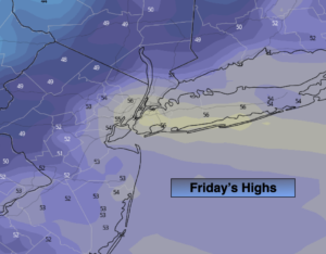
A much less humid airmass has moved in today behind last nights frontal passage. A ridge of high pressure will sit over the East coast. Skies will be mainly sunny. Readings will still be about ten degrees above the average high of 69º. There is no cool air anywhere to be found. Readings on Thursday will top 80º in most areas ahead of another cool front. This front may spark a scattered shower or storm later in the day. The front will be more significant and bring down temperatures to more seasonal levels Friday and Saturday. It’ll finally feel like Fall as high pressure over Eastern Canada dominates.

The high pressure will move over the region and offshore Sunday. Temperatures will pop once again to well above the average highs as winds begin to turn to a Southerly direction. This high looks to park itself over the Eastern Seaboard into next week resulting in above average temperatures and dry conditions.

You know where to find a no hype, no nonsense forecast.

Stay tuned.

Today:

Mostly sunny, warm but much less humid. Highs in the upper 70s. Northwest to North winds at 5-10mph.

Tonight:

Mostly clear. Lows in the mid 60s in the City, the 50s inland. Southeast to South wind under 5mph.

Thursday:

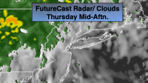
Partly sunny and warm. A late day shower or storm is possible. Highs in the lower 80s.

Friday:

Partly sunny, much cooler. Highs around 70º.

Saturday:

Mostly sunny. Seasonal. Highs around 70º.

Sunday:

Mostly sunny, much warmer. Highs in the upper 70s.

Keep it here for a no nonsense, no hype forecast.


Tornado Watch for Parts of the Area This Evening. Less Humid Wednesday…

Synopsis:

***Tornado Watch for areas North and West of NYC through Midnight*** Any severe thunderstorms that develop have the potential to produce a tornado. A watch means just that we “watch the situation”.  If a tornado warning is issued for your area please seek shelter immediately.

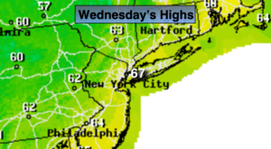
A weak cool front will approach this evening. Scattered showers and storms will occur through early tonight. A few of the storm s maybe strong to severe. Please keep an eye to the sky for threatening weather. The front (more like a humidity buster, rather than a cool front) will usher in a much less humid airmass for Wednesday. Readings will still be about ten degrees above the average high of 69º as there is no cool air behind the front.  Readings on Thursday will top 80º in most areas ahead of another cool front. This front will be more significant and bring down temperatures to more seasonal levels Friday and Saturday. It’ll finally feel like Fall as high pressure over Eastern Canada dominates.

The high pressure will move over the region and offshore Sunday. Temperatures will pop once again to well above the average highs as winds begin to turn to a Southerly direction. This high looks to park itself over the Eastern Seaboard into next week resulting in well above average temperatures and dry conditions.

You know where to find a no hype, no nonsense forecast.

Stay tuned.

Tonight:

Scattered showers and storms early (some of the storms maybe strong to severe) otherwise, partly cloudy. Lows in the mid 60s in the City, the upper 50s inland. Southwest to Northwest wind under 5mph.

Wednesday:

Mostly sunny, warm but much less humid. Highs in the upper 70s. Northwest to North winds at 5-10mph.

Thursday:

Partly sunny and warm. Highs in the lower 80s.

Friday:

Partly sunny, much cooler. Highs around 70º.

Saturday:

Mostly sunny. Seasonal. Highs around 70º.

Sunday:

Mostly sunny, much warmer. Highs in the upper 70s.

Keep it here for a no nonsense, no hype forecast.


Not Feeling Like October. Warm Times Ahead…


Synopsis:

High pressure off the Mid-Atantic coast will pump a warm and moderately humid airmass today. A mix of sun and clouds is expected. A weak cool front will approach later in the day and at night. Scattered showers and storms are p0ssible later in the day, but the greatest chance is during the evening. It’ll be warm with readings almost ten degrees above average. The average high is 69º. Another high will move in for the middle and end of the week. Above normal temperatures can be expected with a mix of sun and clouds. Temperatures will most likely crack 80º Wednesday and or Thursday.

The Autumn chill is banked up in Canada and won’t be heading our way anytime soon.

You know where to find a no hype, no nonsense forecast.

Stay tuned.

Today:

Sun giving way to clouds. Warmer. Scattered late day showers or storms are possible. Highs near 80º. South to Southwest winds at 5-10mph.

Tonight:

Scattered showers and storms early otherwise, partly cloudy. Lows in the mid 60s in the City, the upper 50s inland. Southwest to West wind under 5mph.

Wednesday:

Partly sunny. Warm. Highs near 80º.

Thursday:

Partly sunny and warm. Highs in the lower 80s.

Friday:

Partly sunny, mild. Highs in the mid 70s.

Saturday:

Mostly sunny, cooler. Highs in the lower 70s.

Keep it here for a no nonsense, no hype forecast.


October’s Debut-A Winner…


Synopsis:

October’s debut will be memorable. Plenty of sunshine is expected with mild readings. Highs will be several degrees above the average high of 70º. High pressure is responsible for the fabulous weather. It will slip off the coast and pump up mild air from the South.

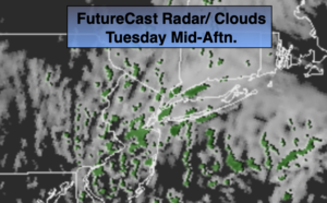
A weak cool front will approach Tuesday. Sun will give way to clouds during the afternoon. Scattered showers are p0ssible later in the day. It’ll be warm with readings almost ten degrees above average. Another high will move in for the middle and end of the week. Above normal temperatures can be expected with a mix of sun and clouds.

You know where to find a no hype, no nonsense forecast.

Stay tuned.

Today:

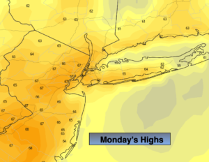
Partly sunny and mild. Highs mid to upper 70s. Southwest winds at 5-10mph.

Tonight:

Partly cloudy. Lows in the mid to upper 60s in the City, the 50s inland. Southwest wind under 5mph.

Tuesday:

Sun giving way to clouds. Warmer. Late day showers are possible. Highs near 80º.

Wednesday:

Partly sunny. Mild. Highs in upper 70s.

Thursday:

Partly sunny and warm. Highs around 80º.

Friday:

Partly sunny, mild. Highs in the mid 70s.

Keep it here for a no nonsense, no hype forecast.


September’s Finale-A Gem…


Synopsis:

High pressure will continue influence the area resulting in our near perfect early Fall conditions. Sunny skies and seasonal readings are expected for September’s finale. The average high is 71º.

The high will move off the coast and pump up a Southwesterly flow of air for the beginning of October next week. A nice, dry stretch will be had with temperatures above average with a decent amount of sunshine through Friday.

You know where to find a no hype, no nonsense forecast.

Stay tuned.

Today:

Mostly sunny. Highs around 70º. North to South wind at 5-10mph.

Tonight:

Partly cloudy. Lows in the lower 60s in the City, the 50s inland. Southwest wind under 5mph.

Monday:

Mostly sunny and mild. Highs mid 70s.

Tuesday:

Partly sunny. Warmer. Highs near 80º.

Wednesday:

Partly sunny. Mild. Highs in upper 70s.

Thursday:

Partly sunny and warm. Highs around 80º.

Keep it here for a no nonsense, no hype forecast.


Sun-Filled Last Weekend of September…


Synopsis:

The sun will be the dominate feature in the sky for a change this last weekend of September. High pressure will move in from the midwest and deliver mainly sunny skies and near seasonal readings. The average high is 71º. It’ll be picture, perfect, pumpkin’, pickin’ weather!

The high will move off the coast and pump up a Southwesterly flow of air for the beginning of October next week. Temperatures will be above average with a decent amount of sunshine. We will finally get a dry stretch after the deluge of the last few weeks.

You know where to find a no hype, no nonsense forecast.

Stay tuned.

Today:

Mostly sunny. Highs in the lower to mid 70s. Northwest winds at 5-10mph.

Tonight:

Clear and chilly. Lows in the mid to upper 50s, the 40s well inland. North wind under 5mph.

Sunday:

Sunny. Highs around 70º.

Monday:

Mostly sunny. Highs in the lower to mid 70s.

Tuesday:

Partly sunny. Warmer. Highs in the upper 70s.

Wednesday:

Partly sunny. Mild. Highs in the mid to upper 70s.

Keep it here for a no nonsense, no hype forecast.


AM Rain, Heaviest East. Tapers off this AM. Some Afternoon Sun…


Synopsis:

Low pressure will slide through the region this morning. Heavy rain has fallen in many areas with up to two inches in spots that has caused flooding of some streams and creeks. The rain will taper off this morning from West to East. The heaviest rain will fall East of the city and along the coast this morning. If you encounter a flooded roadway- TURN AROUND, DON’T DROWN. You never know how deep that water actually is. Skies will begin to clear from Midday on from West to East. The sun will make an appearance for most.

The last weekend of September looks bright with pleasant temperatures as high pressure moves in from the Ohio Valley.

The high will move off the coast and pump up a Southwesterly flow of air. The first few days of October will be warm.

You know where to find a no hype, no nonsense forecast.

Stay tuned.

Today:

Morning rain, the rain maybe heavy early East. The rain will taper off from West to East, some afternoon sun is possible. Highs in the mid to upper 60s. Northeast winds becoming Northwest at 8-12mph.

Tonight:

Mostly clear. Lows in the 50s throughout. West winds at 8-12mph.

Saturday:

Mostly sunny. Highs in the lower to mid 70s.

Sunday:

Sunny, cooler. Highs in the upper 60s.

Monday:

Mostly sunny. Highs in the lower to mid 70s.

Tuesday:

Partly sunny. Warmer. Highs in the upper 70s.

Keep it here for a no nonsense, no hype forecast.


Another Round of Rain Tonight-Friday AM. Some Late Sun Late Day…


Synopsis:

A ripple of low pressure will move up the coastal plain tonight and Friday. A period of rain is  likely late tonight into Friday morning. Some of the rain maybe heavy, especially from the I-95 corridor and to the North and West. A Flood Watch has been posted for a majority of the tri-state area. The potential of one to two inches of rain is there, with the exception of areas well to the East and South (map above). The ground is already saturated so it won’t take much to cause  streams, creeks and highways in flood prone areas to cause an issue. By Friday afternoon the rain will taper off and some late day sun is possible.

The weekend looks bright with pleasant temperatures as high pressure moves in from the Ohio Valley.

You know where to find a no hype, no nonsense forecast.

Stay tuned.

Tonight:

Light Rain developing during the evening hours from Southwest to Northeast. The rain maybe heavy late. Lows in the 50s throughout. Winds East at 8-12mph.

Friday:

Morning rain, the rain maybe heavy early, some late day sun is possible. Highs in the mid to upper 60s. Northeast winds becoming Northwest at 8-12mph.

Saturday:

Mostly sunny. Highs in the lower to mid 70s.

Sunday:

Sunny, cooler. Highs in the upper 60s.

Monday:

Mostly sunny. Highs in the lower to mid 70s.

Tuesday:

Partly sunny. Warmer. Highs in the upper 70s.

Keep it here for a no nonsense, no hype forecast.


Much Less Humid Today. Brief Break in the Rain. Another Round on the Way…


Synopsis:

Today the clouds and sun will battle it out, but the clouds will have the upper hand. It’ll be much cooler and less humid.

A ripple of low pressure will move up the coastal plain tonight and Friday. A period of rain is  likely late tonight into Friday morning. Some of the rain maybe heavy, especially over Western areas. A Flood Watch has been posted for the potential of one to two inches of rain. The ground is already saturated so it won’t take much to cause  streams, creeks and highways in flood prone areas to cause an issue. By Friday afternoon the rain will taper off and some late day sun is possible.

The weekend looks bright with pleasant temperatures as high pressure moves in from the Ohio Valley.

You know where to find a no hype, no nonsense forecast.

Stay tuned.

Today:

Clouds and some sun. Highs in the lower 70s. The average high is 71º. North to East winds at 8-12mph.

Tonight:

Rain developing during the late evening hours. The rain maybe heavy late. Lows in the 50s throughout. Winds East at 8-12mph.

Friday:

Morning rain, the rain maybe heavy early, some late day sun is possible. Highs in the mid to upper 60s.

Saturday:

Mostly sunny. Highs in the lower to mid 70s.

Sunday:

Sunny, cooler. Highs in the upper 60s.

Monday:

Mostly Sunny. Highs in the lower 70s.

Keep it here for a no nonsense, no hype forecast.


Scattered Showers /Storms Early Tonight. Much Less Humid Thursday…


Synopsis:

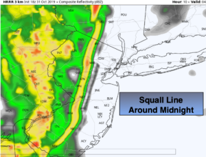
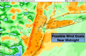
It’ll be very humid into this evening. A cool front will be approaching with scattered showers and possibly a thunderstorm from 7pm to around the midnight hour. A few areas will experience torrential downpours and gusty winds. The humidity will drop drastically by late tonight.

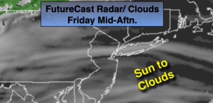
Thursday will start off with some sun but clouds will dominate the second half of the day. It’ll be much cooler and less humid.

A weak ripple of low pressure will move up the coastal plain Thursday night and Friday. A period of rain is looking probable for the first half of Friday.

The weekend looks bright with pleasant temperatures.

You know where to find a no hype, no nonsense forecast.

Stay tuned.

Tonight:

Scattered showers and storms this evening, otherwise mostly cloudy. Becoming much less humid by morning. Lows around 60º in the City, the 50s inland.  North to Northwest winds 8-12mph.

Thursday:

Sun and Clouds. Highs in the lower 70s. The average high is 71º. North to East winds at 8-12mph.

Friday:

Morning rain, some late day sun is possible. Highs in the mid to upper 60s.

Saturday:

Mostly sunny. Highs in the lower to mid 70s.

Sunday:

Sunny, cooler. Highs in the upper 60s.

Monday:

Mostly Sunny. Highs in the lower 70s.

Keep it here for a no nonsense, no hype forecast.