Synopsis:
A front with a developing storm to our North and West will approach tonight. A quick hitting rain is on the way from 11pm to 4am. Local downpours are likely. Winds will increase as the front approaches and moves through. Gusts up to 45mph can be expected toward daybreak.
We’ll dry out on Thursday as the sun returns with a strong Northwest wind. Colder temperatures will greet us the last few days of February. March is Sunday and it will come in like a lamb.
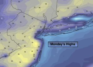
Late day showers are possible on Monday with readings once again getting above average. The average high is 44º.
Stay Tuned.
Keep it here for a no nonsense, no hype forecast.
Tonight:
On and off light rain and drizzle becoming a steady rain for a few hours toward midnight. Lows around 40º throughout. East winds will become Southwest late at 10-15mph. Winds will dramatically increase a few hours before sunrise and gust up to 45mph out of the West.
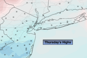
Thursday:
Partly sunny and windy. Highs in the mid 40s. West winds at 15-30mph with gusts to 45mph.
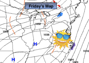
Friday:
Partly sunny. Highs around 40º.
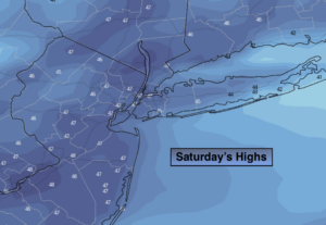
Saturday:
Partly sunny. Colder. Highs in the upper 30s.
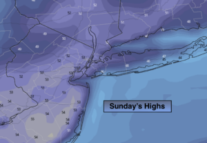
Sunday:
Partly sunny. Highs around 40º.
Monday:
Mostly cloudy with afternoon showers. Highs in the mid 40s.