Synopsis:
Today will be Spring-like with readings well into the 50s as strong high pressure moves to the East coast and a Southwesterly flow develops.
Due to Daylight Saving Time the sun will set today at 6:55PM!
Well above average temperatures will continue into early next week. Readings on Monday will approach a May-like 70º. Showers are possible later Tuesday with an approaching front.
Mild readings will be with us through the end of week.
Spring officially arrives on March 19th.
Stay Tuned.
Keep it here for a no nonsense, no hype forecast.
Today:
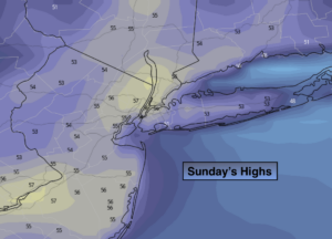
Sunny. Much milder. Highs in the mid to upper 50s. West winds at 8-12mph.
Tonight:
Clear. Not as cold as last night. Lows in the mid 40s in the City, the 30s inland. Southwest winds at 5mph.
Monday:
Sunny and warm. Highs in the 60s to around 70º.
Tuesday:
Sun giving way to clouds. Afternoon showers likely. Highs in the mid 60s.
Wednesday:
Partly sunny and mild. Highs in the mid to upper 50s.
Thursday:
Partly sunny. Highs in the lower to mid 50s.