Synopsis:
Today will be mostly sunny and chilly with a gusty Northwest wind behind an intense North Atlantic storm.
Time to “Spring Ahead” tonight. Daylight Saving Time returns at 2AM. Don’t forget to turn your clocks ahead one hour before hitting the sack. It’s also a good time to change the batteries in your smoke and carbon monoxide detectors. The sun will rise an hour later Sunday morning but will set an hour later in the evening!
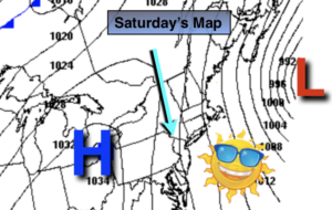
Sunday will be Spring-like again with readings well into the 50s as high pressure moves to the East coast and a Southwesterly flow develops.
Well above average temperatures will continue into early next week. Showers are possible later Tuesday with an approaching front.
Stay Tuned.
Keep it here for a no nonsense, no hype forecast.
Today:
Mostly sunny, breezy and chilly. Highs in the mid 40s. Northwest winds at 15-25mph.
Tonight:
Clear and cold. Lows in the lower to mid 30s in the City, the 20s inland. Northwest to West winds diminishing to 5mph.
Sunday:
Sunny. Much milder. Highs in the mid to upper 50s.
Monday:
Sunny. Warm. Highs in the mid 60s.
Tuesday:
Sun giving way to clouds. Afternoon showers likely. Highs in the lower 60s.
Wednesday:
Partly sunny and mild. Highs in the mid to upper 50s.