Synopsis:
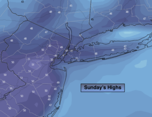
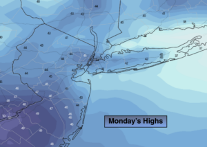
Strong high pressure will dominate the Northeast today resulting mostly sunny skies with readings below the average high of 50º.
Clouds will increase tonight and there’s a chance of showers after midnight.
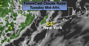
Unfortunately, St. Patrick’s day on Tuesday looks damp as showers are in the forecast as a front moves in from the West. It’ll be milder.
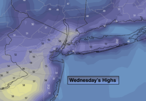
Wednesday will be bright and chilly as high pressure moves toward the Northeast from Canada.
Another round of showers are possible Thursday, the first day of Spring.
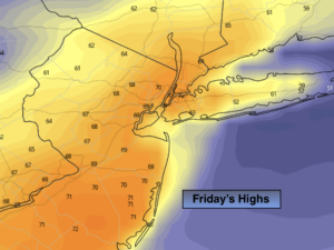
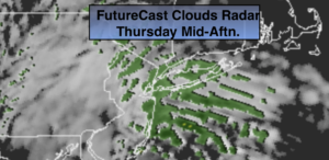
Much warmer conditions are expected by Friday with readings getting into the lower 70s. Showers are likely during the afternoon with an approaching cool front.
Stay Tuned.
Keep it here for a no nonsense, no hype forecast.
Today:
Sunny and chilly. Highs mid 40s. Northeast to Southeast winds at 8-12mph.
Tonight:
Cloudy with showers late. Lows around 40º in the City, the 30’s in the ‘burbs. Southeast winds at 5mph.
Tuesday (St. Patrick’s Day):
Mostly cloudy with a chance of showers, mainly in the morning. Highs in the mid 50s.
Wednesday:
Sunny. Highs near 50º.
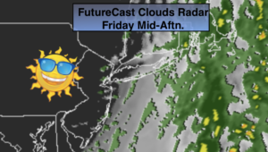
Thursday:
Mostly cloudy with scattered showers. Milder. Highs in the mid to upper 50s.
Friday:
Partly sunny. Balmy. Highs in the lower 70s.
***Please take the “social distancing” seriously during this time. We will get through this.****