Synopsis:
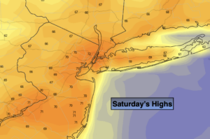
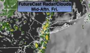
Spring 2020 will be one to remember, especially for meteorologists. The NYC vicinity experienced it’s latest snowfall on record (tied with May 9th 1977). Light snow fell at around 1:30am and then again during the afternoon. It was quick, but unprecedented for May. Record cold was also experienced Saturday morning. The temperatures fell to 34º at Central Park, breaking the cold record of 35º set in 1947.
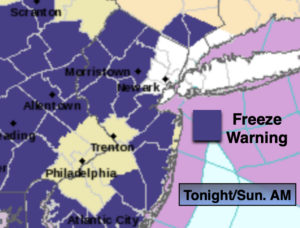
Any scattered snow showers will end this evening. Skies will be mostly clear tonight it will be cold with diminishing winds. The Canadian airmass will spend one more night with us. A Freeze Warning is in effect for many areas. Please bring in potted plants and cover any tender vegetation.
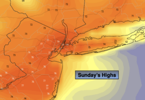
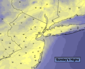
Improving weather is on the way for Mother’s Day. High pressure will move off the Southeast coast. A mix of sun and clouds is expected. Readings will still be well below the average high of near 70º.
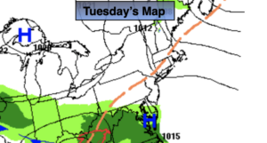
Next week will start off a bit unsettled with a disturbance moving in from the West. A few showers are possible Monday. Tuesday will be bright and cool.
Wednesday and Thursday will see moderating temperatures. Finally feeling like Spring.
Stay Tuned.
Keep it here for a no nonsense, no hype forecast.
Tonight:
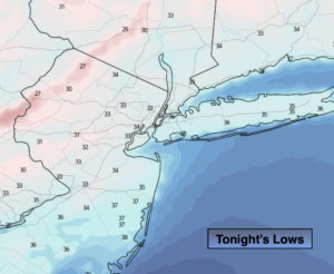
A scattered evening snow shower, otherwise skies will become mostly clear. It will be Cold. Lows near 40º in the City, the upper 20s and 30s inland. Winds will diminish from the West at 10-15mph.
Mother’s Day:
Sun and clouds, breezy and cool. Highs in the lower 60s. West to Southwest winds at 10-20mph with gusts to 25mph.
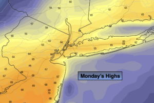
Monday:
Mostly cloudy. Chance of showers. Highs around 60º.
Tuesday:
Mostly sunny. Chilly. Highs in the upper 50s.
Wednesday:
Sunny. Milder. Highs in the mid 60s.
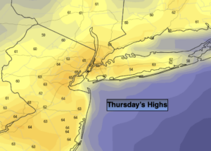
Thursday:
Sunny. Seasonal. Highs in the upper 60s.