Synopsis:
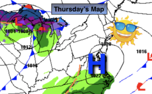
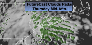
A hiccup will occur with our sunny, warm weather. An onshore flow will bring moisture in off the ocean in the form of clouds today. Spotty drizzle is a possibility during the afternoon as the RPM model above indicates. It will be much cooler with a wind off the cold Atlantic .Readings will only be in the mid to upper 40s (which is seasonal for this time of the year).
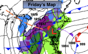
Periods of rain is expected tonight with an approaching front.
On Friday, the front will move through during the morning with rain. The rain will quickly end toward midday and the sun will return. It’ll be very warm by mid afternoon.
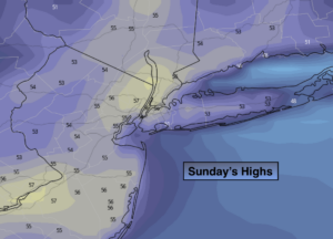
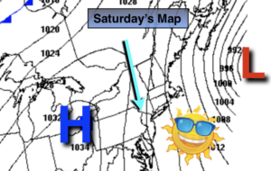
Saturday will be bright with cooler temperatures but by no means will it be cold. By Sunday readings will finally be near the seasonal averages of the upper 40s as Canadian high pressure influences the region.
Spring officially arrives on March 19th.
Stay Tuned.
Keep it here for a no nonsense, no hype forecast.
Today:
Mostly cloudy with a chance of spotty drizzle during the afternoon. Much cooler. Highs in the mid to upper 40s. East winds at 5-10mph.
Tonight:
Periods of rain. Lows in the 40s throughout. East to Southeast winds at 5-10mph.
Friday:
Morning rain will give way to afternoon sun. Balmy. Highs around 70º.
Saturday:
Mostly sunny. Highs in the lower to mid 50s.
Sunday:
Partly sunny. Seasonal. Highs upper 40s.
Monday:
Sunny and cool. Highs mid to upper 40s.