Synopsis:
Bright and cooler weather will be with us for the first weekend of Spring. Strong high pressure will settle over the Northeast. Clouds will give way to sun today.
Tonight will be cold with most areas at or below freezing.
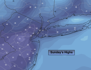
Abundant sunshine and below average temperatures are expected for Sunday.
On Monday a storm will develop off the Mid-Atlantic coast. Rain will develop along the coast (could be a bit of wet snow at the onset). Inland a mix of wet snow and rain is likely. The potential for some accumulation exists. JMW will fine tune possible amounts later today.
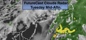
The sun will return Tuesday along with seasonal temperatures (the average high is 52º).
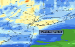
Another round of rain will occur on Wednesday.
Stay Tuned.
Keep it here for a no nonsense, no hype forecast.
Today:
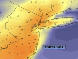
Clouds to sun. Cooler. Highs in the lower 50s. North winds at 8-12mph.
Tonight:
Clear and cold. Lows around freezing in the City, the 20s inland. North/Northeast winds at 8-12mph.
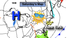
Sunday:
Sunny. Chilly. Highs in the mid 40s.
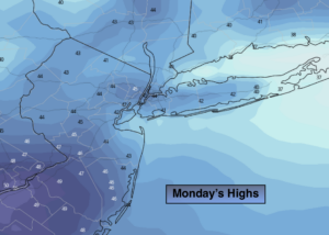
Monday:
Cloudy with a chance of rain. The potential exists for some wet snow North and West. Highs in the lower 40s, 30s inland.
Tuesday:
Mostly sunny. Seasonal. Highs around 50º.
Wednesday:
Rain likely. Highs around 50º.
***Please take “social distancing” seriously during this time. We will get through this.****