Synopsis:
The low that gave us the quick shot of heavy rain last night has moved out to sea. These last few hours of Winter will be grey with a few scattered showers. Spring arrives at 11:50PM EDT tonight.
Much warmer conditions are expected by Friday with readings getting into the 70s with a Southwest wind. It will be much cooler closer to the ocean. A mix of sun and clouds is expected along with spotty showers as a cool front approaches.
Bright and cooler weather will greet us for the weekend due to strong high pressure over the Northeast.
Monday’s forecast all depends on the track of a developing storm off the Mid-Atlantic coast. If the storm is close enough rain and even some wet snow is possible. If the storm stays offshore little if any precipitation will fall.
Stay Tuned.
Keep it here for a no nonsense, no hype forecast.
Today:
Cloudy with scattered showers. Highs in the lower 50s. Northeast winds at 5mph.
Tonight:
Mostly cloudy. Lows in the upper 40s to lower 50s. East winds at 5mph.
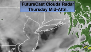
Friday:
Sun and clouds. Balmy. Slight chance of a shower. Highs in the mid 70s. Much cooler over Long Island and Connecticut.
Saturday:
Mostly sunny. Cooler. Highs in the lower 50s.
Sunday:
Sunny. Chilly. Highs in the mid 40s.
Monday:
Mostly cloudy. Showers possible. Cooler. Highs in the mid 40s.
***Please take “social distancing” seriously during this time. We will get through this.****