Synopsis:
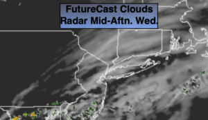
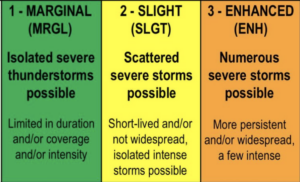
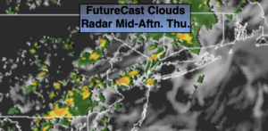
A weak low will ride along the Mid-Atlantic today at the same time a cool front will be approaching. On and off rain will occur today and into tonight. There will be areas of torrential rain. This could lead to flooding of streets and highways. Never drive through a flooded roadway. You don’t know how deep that water is. TURN AROUND-DON’T DROWN. It will be humid with readings near the average high of 78º
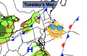
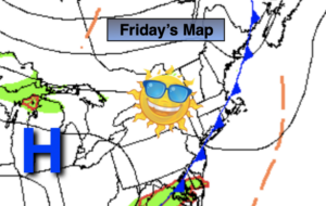
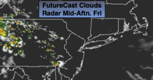
As the front pushes offshore on Friday any morning (especially by the coast) will give way to mostly sunny skies. High pressure will build in from Canada. This will result in much lower humidity. Seasonal temperatures are expected.
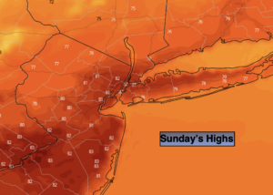
The beginning of the weekend will have a Fall feel under mainly sunny skies. Saturday will be the better half of the weekend with readings several degrees below average. Sunday’s forecast includes the threat of showers by afternoon as a front approaches.
Stay Tuned.
Keep it here for a no nonsense, no hype forecast.
Today:
On and off rain. Local downpours. Humid. Highs in the upper 70s. East to Southeast winds at 5-10mph.
Tonight:
On and off rain. Local downpours. Muggy. Lows in the 60s throughout. South to North winds at 5-10mph.
Friday:
Scattered morning coastal showers, otherwise becoming mostly sunny and less humid. Highs in the upper 70s.
Saturday:
Sunny. Cool. Highs in the lower to mid 70s.
Sunday:
Mostly cloudy. Showers likely during the afternoon. Highs in the upper 70s.
Monday:
Partly sunny. Highs around 80º.