Synopsis:
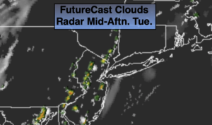
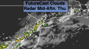
A cool front will approach today. Skies will be mainly cloudy . Temperatures will be cooler do to the clouds and scattered showers and storms expected. It won’t be raining all the time. The highest concentration of showers and storms will be from the City and to the South. Some of the rain maybe torrential. A Flash Flood Watch is up for Central and Southern NJ.
Isolated evening storms this evening, otherwise mostly cloudy overnight.
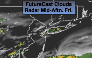
Friday’s forecast has changed for the better. The front now looks to push offshore far enough to keep much of the rain to the South. Clouds will give way to sunshine with much lower levels of humidity.
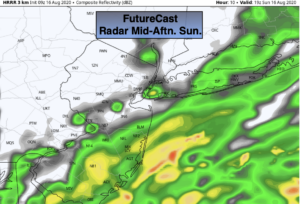
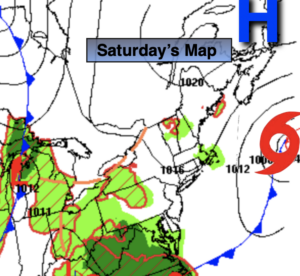
The weekend is looking like a 50/50 split. Saturday will be brighter and comfortable with high pressure over Eastern Canada will be responsible for our August delight. Sunday’s forecast has changed, its not etched in stone, but the potential is there for a round of showers and storms. Cooler readings are expected as a weak disturbance rides through the region.
Stay Tuned.
Keep it here for a no nonsense, no hype forecast.
Thursday:
Mostly cloudy. Cooler. Scattered showers and storms. Not all areas will get into the action. Highs in the lower 80s. Northeast winds at 5-10mph.
Tonight:
A spotty evening storm, otherwise partly cloudy. Lows in the lower 70s in urban areas, the 60s inland. Northeast winds at 5mph or less.
Friday:
Clouds to sun. A few showers are possible to the South. Much less humid. Highs in the lower to mid 80s.
Saturday:
Partly sunny and comfortable. Highs in the lower 80s.
Sunday:
Mostly cloudy. Chance of showers and storms. Highs in the upper 70s.
Monday:
Partly sunny. Highs in the mid 80s.